


2. STEERING MODES
2-5
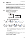
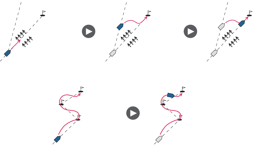
2.3 NAV Mode
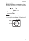
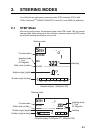
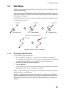
NAVpilot steers the vessel towards the current waypoint while compensating for the
effects of tide and wind.
When connected to a GPS Navigator, NAVpilot steers the vessel to follow a series of
waypoints in sequence. When you arrive at each waypoint or destination, audible and
visual alerts are activated.
The NAVpilot takes 15 seconds to activate the NAV mode after the NAVpilot receives
the destination information.
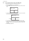
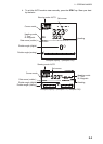
2.3.1 How to get the NAV mode
To get the NAV mode, do as follows:
1. Set the destination waypoint (or route) on the GPS navigator or chartplotter.
(To navigate a route, make sure that your plotter is navigating towards the nearest
or required waypoint before you put the NAVpilot into the NAV mode.)
2. Manually steer the boat toward the waypoint.
3. Press the NAV key.
4. You are asked if you are sure to navigate to the waypoint selected. Push the Con-
trol course knob to start to navigate to the waypoint.
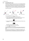
Note 1: The course reading on the NAVpilot is not always the same as the waypoint
direction shown on the chartplotter.
Note 2: You can switch between nav data sources (for example, one source fails) by
pressing the NAV key three seconds. (This feature is not available when [BOTH] is
selected as nav data source on the [NAV DATA SOURCE] menu, set during the in-
stallation.
Waypoint
Tide and Wind
Waypoint
Tide and Wind
Waypoint
Tide and Wind
Waypoint Waypoint
Steering a route (a series of waypoints)
Steering to a single waypoint