


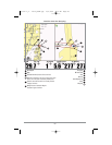
Chart Orientation
All the chart views allow you to choose the orientation of the chart. When North-Up orientation is selected,
True North is shown at the top of the display. In other words, objects located to the north of the boat are
drawn above the boat. When Course-Up orientation is selected, the direction of motion of the boat is
shown at the top of the display. In other words, objects ahead of the boat are drawn above the boat. In
both orientations, the view pans automatically, so that the boat is always centered on the display. When
the boat is stationary, it is drawn as a circle. When the boat is in motion, it takes on a boat shape, pointed
in the direction of motion (always Up in the Course-Up orientation). See Navigation Menu Tab: Chart
Orientation for more information.
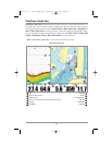
Viewing Cartography
In the Chart or Combo Views, there are several cartography-related functions that you can access using
various keys.
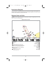
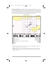
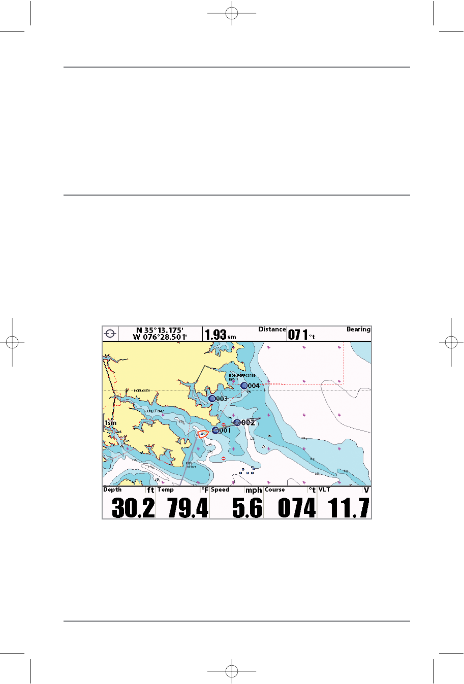
Panning: Use the 4-WAY Cursor keys to move the chart around on the display in the direction of the key
being pressed. When you do this, a Bullseye Cursor is drawn at the top of the screen and is linked to the
boat by a yellow line, even if the boat is off the screen. At the same time, a cursor dialog box is displayed
at the top of the screen with the distance and bearing from the boat to the cursor position and the
latitude/longitude coordinates of the cursor. When the cursor is active on the display, you can also use the
4-WAY Cursor Control key to move the cursor diagonally.
Zooming: Use the Plus (+) key to Zoom In and the Minus (-) key to Zoom Out showing the cartography
at different scales. The scale is indicated on the left side of the display. If you zoom in beyond the
available chart data, the display will go into Overzoom mode whereby the last available chart data is
amplified to reflect the scale selected. If you zoom in so far that no cartography is available, a lat/lon
grid will be drawn instead.
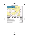
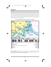
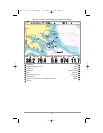
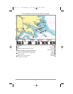
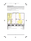
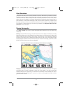
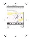
Chart View with Cursor Present, with optional-purchase Navionics® cartography
91
531617-1_A - 1197c_ManE.qxp 11/6/2007 4:38 AM Page 91