


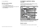

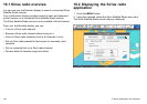

15.4 Weather map navigation
You can move around the weather map and place waypoints.
When you open the weather application, a world map is displayed.
If the system has a position x for your boat, the map will be centred
on your boat. As in the chart application, use the cursor to move
around the map and view different locations, and the Range control
to zoom in and out. Use the WPTS MOB button to place waypoints.
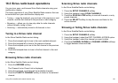
Re-centering your vessel on the weather map
In the weather application:
1. Press the FIND SHIP softkey.
15.5 Weather reports
You can view a number of different weather reports to give you a
comprehensive view of the weather.
Your multifunction display shows weather reports for:
• Tropical statements.
• Marine warnings.
• Marine zone forecasts.
• Marine watchbox warnings.
Tropical statements
Tropical statements provide information on tropical weather
conditions. This information may not be available in all areas.
Marine warnings
You can display a report for the current marine warnings in the US
coastal or near shore areas, or for the zone around your cursor
or vessel.
Marine zone forecasts
These forecasts cover:
• US Coastal Weather Forecasts and Offshore Forecasts and High
Seas Forecast, or
• Great Lakes Forecast and Near Shore Forecast, or
• Canadian Coastal Weather Forecast.
Marine watchbox warnings
When a tornado or thunderstorm warning is received within the
specied range of your vessel (MENU > Weather Setup Menu >
Marine Watchbox Alerts), the system generates a watchbox alert.
This alert provides information on the type of warning and validity
period. The full watchbox report text is also displayed.
Using the weather application (North America only)
185