


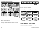
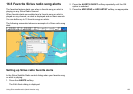
Displaying weather reports
In the weather application:
1. Press the WEATHER REPORTS softkey.
2. Press the TROPICAL STATEMENTS, MARINE WARNINGS,
MARINE ZONE FORECASTS, or MATCHBOX WARNINGS
softkey, as appropriate.
The relevant report, warning, or statement is displayed.
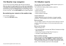
Changing the position of forecasts on the
weather map
In the weather application:
1. Press the WEATHER REPORTS softkey.
2. Press the FORECAST AT softkey until the CURSOR or SHIP
option is selected, as appropriate.
Note: You cannot change the position of TROPICAL
STATEMENTS or WATCHBOX WARNINGS.
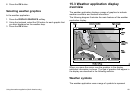
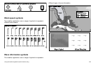
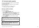
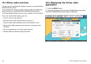
15.6 Storm tracking
The storm tracking function enables you to monitor signicant
storms in the area.
Examples of signicant storms include tropical disturbances,
depressions, storms and cyclones, hurricanes, typhoons, and super
typhoons.
The weather map displays the track that the storm has taken, its
current and forecasted position, the wind radii (current position
only), direction, and speed of travel.
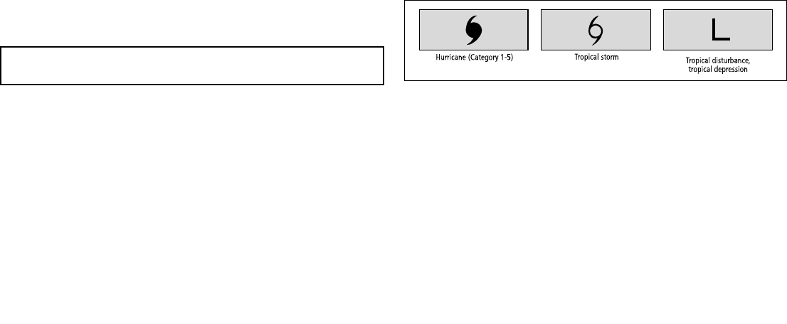
Storm tracks are highlighted on the weather map in the form of
symbols, as shown below.
When you move the cursor over a symbol, additional storm
information is displayed.
Hurricane (Category 1-5)
Tropical storm
Tropical disturbance,
tropical depression
186 C-Series Widescreen user reference