


6.3 Using the chart safely
When using your chartplotter you should always check that a route
is safe.
Zoom in to check for hazards, such as small shoals, that may
not be shown on a smaller scale chart. Until you are familiar with
interpreting the chart display, you should take every opportunity to
compare the displayed objects with visual targets, such as buoys
and coastal structures. You should practice harbour and coastal
navigation during daylight and in clear weather conditions. The
simulator mode can also be used to help you gain experience.
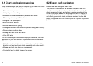
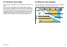
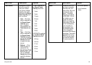
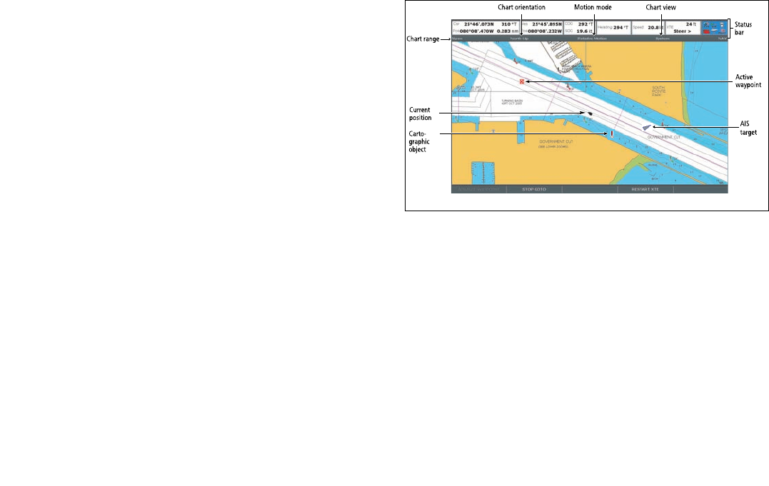
6.4 What the chart displays
The chart display has a number of features to help you navigate.
The following diagram illustrates the main features:
Chart range
Chart orientation
Motion mode
Status
bar
Current
position
Carto-
graphic
object
Active
waypoint
Chart view
AIS
target
Using the chart
51