85
The height scale on the top right side of the graph changes, based upon
the maximum range of the tide for that day. The MLLW line also ad-
justs its position as the height scale changes.
You can look up tidal data for other dates by changing the month, day
and year selection boxes. To select another date:
1. Use → and ← to highlight month, day or year, then press
ENT.
2. Use ↑ and ↓ to select the desired month, day or year, then press
ENT.
To clear the information screen, press
EXIT.
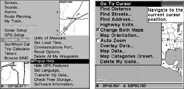
Pop-up Help
Help is available for virtually all of the menu labels on this unit. By
highlighting a menu item and leaving it highlighted for a few seconds, a
"pop-up" message appears that describes the function of the menu item.
This feature is on by default.
To set up Popup Help: Press
MENU|MENU|↓ to SYSTEM SETUP|ENT|↓
to
POPUP HELP. With the option highlighted, press ENT to check it (turn
on) and uncheck it (turn off.) After the option is set, press
EXIT|EXIT to
return to the page display.
System Setup menu, left, with Pop-up Help command highlighted. At
right, this example shows the Pop-up Help message for the Go To Cur-
sor command, located on the Map Menu.
Position Pinning
When you are standing still or moving at extremely slow speed, a GPS
receiver can have trouble determining the direction you are traveling.
In the past, this resulted in a "wandering" plot trail that moved around
the map, even if you were standing still.


