


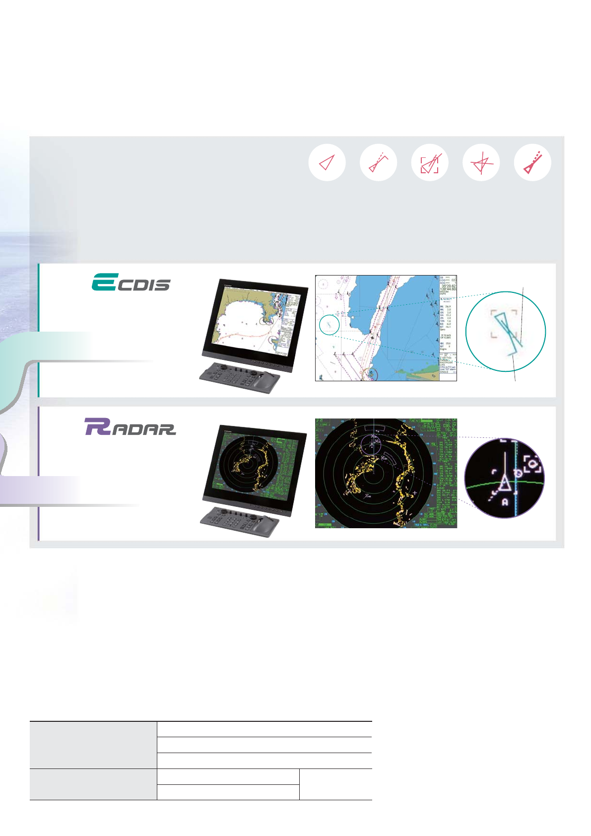
COG/SOG vector
ROT mark
Electronic Chart Display and Information System
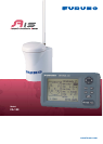
Combined antenna
A Class-A Universal Automatic Identification System (UAIS)
transponder, the FA-150 is designed to improve navigation
safety by observing other AIS equipped ships. The FA-150
complies with relevant international regulations and
standards (e.g., IMO, ITU-R, IEC) as well as national class
requirements.
The FA-150 offers real-time information exchange of your
own ships data and other AIS-equipped ships or coastal
stations within VHF coverage. Information that is exchanged
includes static, dynamic, voyage related data, as well as
short safety-related messages.
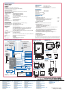
The FA-150 consists of a GPS antenna, a transponder unit,
a display unit and other associated equipment. The internal
GPS receiver provides UTC reference for system
synchronization. It also gives position, COG and SOG if no
external positioning equipment is connected. There are two
types of configurations for the antenna unit: GPS and VHF
combined and separate antennas. Both types of GPS
antennas feature a special interference shield that allows
superior performance when they are in an area of influence
by equipment such as radar and satellite phones.
An exceptionally compact GPS antenna is also available in
the separate configuration.
The FA-150 can be interfaced with Radar and ECDIS,
allowing AIS information to be displayed on them.
No additional interface units are required for connection to
the FURUNO radar or ECDIS. Use of the WAGO connectors
simplifies installation and connection.
.
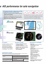
AIS enhances detection of other ships and Aids
to Navigation on radar and ECDIS units.
fAIS targets are visible even if they are behind large ships,
islands or other landmasses
f
AIS targets are not obscured by sea clutter and rain clutter
fROT display at tip of COG/SOG vector allows navigators to
predict course changes of other vessels
AIS COG/SOG vector changes its length with speed and
a ROT mark is viewable at the COG/SOG vector tip when
a target ship is equipped with a FURUNO satellite
compass SC-50/110 or other compatible equipment.
Sleeping AIS Target Activated Target Lost Target Dangerous TargetSelected Target
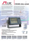
Automatic Identication System
FA-150
f
Compact 4.5" silver bright display
f
Full compliance with international regulations and standards
t IMO MSC.74(69) Annex 3 t ITU-R M.1371 t IEC 60993-2
t IEC 60945 t MTSA 2002 - U.S. AIS Requirements
f
Integrates with Radar, ECDIS and Electronic Chart System
f
Easy to operate
f
Optional PC software
f
Provides real-time AIS info for collision avoidance
fProvides real-time AIS information
for collision avoidance
fA means for coastal stations to obtain
information about a ship and its cargo
fVTS tool, i.e., ship-to-shore
trafc management
AIS features include:
Target list Plotter Alarm status Own dynamic data Own static data
Implementation schedule
fStatic Data
MMSI (Maritime Mobile Service Identity)
IMO number (Where available)
Call sign & name
Length and beam
Type of ship
Location of position-fixing antenna on the ship
fDynamic data
Ship’s position with accuracy
indication and integrity status
Coordinated universal time (UTC)
Course over ground (COG)
Speed over ground (SOG)
Heading
Navigation status (manual input)
Rate of turn (where available)
Update rates Dependent on speed
and course alternation (2 s – 3 min)
fVoyage related data
Ship’s draft
Hazardous cargo (type)
Destination and ETA (at masters discretion)
fShort safety-related messages
Free messages
Information to be exchanged
Before 1 July 2008
(MSC.73 adopted on 5 December 2001 and Amendments adopted on 13 December 2002 by
the Conference of Contracting Governments to the SOLAS 1974)
New build
All ships of ≥300 GT on international voyages
Cargo ships ≥500 GT not on international voyages
Passenger ships irrespective of size on all voyages
Passenger ships
Ships, other than passenger ≥500 GT
Ships not on international voyages
constructed before 1 July 2002
PC software
Optional PC software is available
to facilitate comprehensive
observation of AIS information.
With this software application,
chart overlay*, target information
and targets list can be displayed
on one display.
*Requires chart data
NOTE: All vessels in U.S. waters - Complies with MTSA 2002 (Maritime Transportation Security Act) U.S. AIS Requirements
Separate GPS antennas
FURUNO offers reliable AIS performance for safe navigation