


4
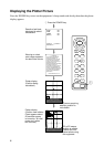
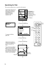
Displaying the Plotter Picture
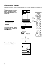
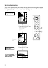
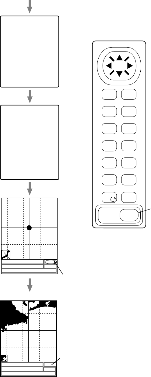
Press the POWER key to turn on the equipment. A beep sounds and shortly thereafter the plotter
display appears.
Results of self-test;
displayed for about
one second.
Warning on chart
card usage; appears
for about one minute.
ACQ means acquiring
satellite; position is
not reliable.
Plotter display
(Position being
calculated.)
ROM
RAM
VRAM
Battery
Program No.
Base Chart No.
OK
OK
OK
OK
=
02522531**
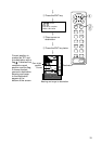
=
NO NATIONAL HYDROGRAPHIC
OFFICE HAS VERIFIED THE
INFORMATION IN THIS COASTLINE
DATA CARD AND NONE ACCEPT
LIABILITY FOR THE ACCURACY OF
REPRODUCTION OR ANY
MODIFICATIONS MADE THEREAFTER.
THIS PRODUCT WITH THIS
COASTLINE DATA CARD DOES NOT
REPLACE THE REQUIREMENT TO
USE THE APPROPRIATE PRODUCTS
FOR NAVIGATION ACCORDING TO
NATIONAL AND INTERNATIONAL
REGULATONS.
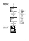
— — WARNING— —
FURUNO ELECTRIC CO., LTD.
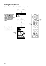
BRG+ 232.0° RNG+ 0.00nm ACQ
DEP 110m TMP 16 .0°C 13:41
+ 34°43.801’N 135°21.163’E
BRG+ 232.0° RNG+ 0.00nm 2D
DEP 110m TMP 16 .0°C 13:41
+ 34°43.801’N 135°21.163’E
Plotter display
(Position now reliable.
Chart appears about
20 sec after power
is turned on. At initial
power on it takes
two minutes.)
2D or 3D means
position is reliable.
Confirm this indi-
cation before using
the equipment.
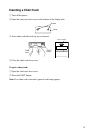
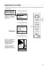
1 Press the POWER key.
MENU
ESC
NU/CU
ENT
SNDR
1
PLTR
6
AUTO
2
EVENT
MOB 7
WPT
3
GOTO
8
ZOOM
OUT 9
CNTR
5
CLR
TONE
POWER
ZOOM
IN 4
CURS
0
1