


Page 70 CPF180i and CPF300i
9.6 OTHER SETTINGS IN ROUTE MENU
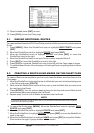
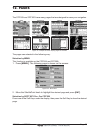
You will notice the ROUTE menu has other selections.
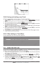
SELECT Choose an available Route to create or choose a stored Route to show and follow on the Chart page.
REVERSE Reverses the Route, when chosen Starting point is at the end of the Route.
COLOR Allows changing the color of the navigation lines between each leg in the Route.
REPORT The Route Report menu is useful to show details of the Waypoints contained within the Route. This menu
also allows you to enter in your average speed and fuel consumption and calculate the approximate fuel
used when following the Route.
SEND Sends the stored points to a external device (PC) capable of listening to NMEA RTE sentence.
RECEIVE Receive the points from an external device (PC) capable of sending NMEA RTE sentence.
THICKNESS Selection that allows the Route line to be easily seen; default selection is Thick.
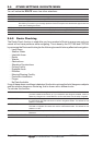
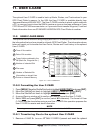
9.6.0 Route Checking
The Route Check function is used after you have created a Route to ensure you and your
vessel will not have problems while navigating. This is done by the CPF180i and CPF300i
by reviewing the Route and looking for the following hazards that may effect safe navigation.
· Land Areas
· Shallow Water
· Intertidal Areas
· Rocks
· Wrecks
· Obstructions
· Shoreline Constructions
· Fishing Facility
· Dredged Areas
· Diffusers
· Mooring/Warping Facility
· Production Installation
· Pingos
· No Data Available
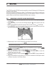
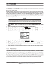
If any of these alarm conditions is detected, the function returns the list of dangerous objects
and the relative dangerous Route leg, that is drawn with a different color.
To activate this function:
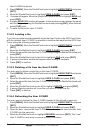
AUTOMATIC CHECK Turns the Route Checking feature On or Off. Turn the Automatic Route Check on after
you have created a new Route, or if you inserted a new Waypoint, deleted, moved or
edited any Waypoint in a saved Route to confirm the Route can be safely navigated.
ROUTE WIDTH This selection allows you to select the width from the left and right of the Route line where
the CPF180i or CPF300i will check to confirm navigation threats. The default for this
selection is 0.04NM.
DEPTH LIMIT This selection allows you to select the water depth in the Route width area so the
CPF180i or CPF300i can check and confirm underwater threats. The default for this
selection is 10FT.
ACCURACY Selects the accuracy for the Route check, among Minimum, Low, Medium, High and
Maximum.
ROUTE CHECK REPORT Shows the list of the dangerous objects found on the charts crossed by the Route.