


3. PLOTTER OPERATION
3-17
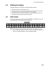
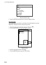
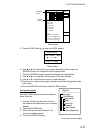
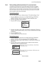
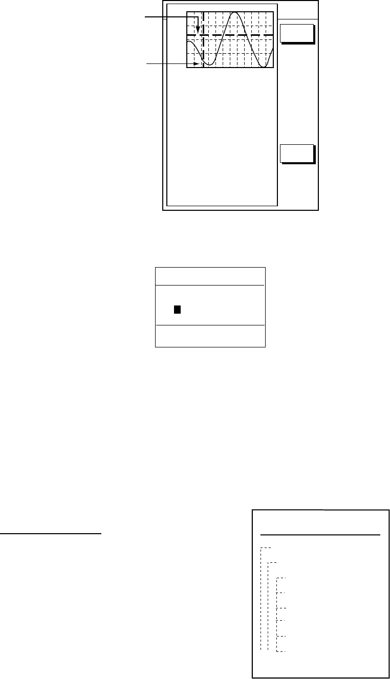
Time: 04:35
Height: 0.45ft
Draught: 0.65ft
01/07/30 +13:30
43° 32.860N
010° 18.022E
Port info
LIVORNO (LEGHORN)
High Water(max)
0.86ft(13:30 L)
Low Water(min)
0.35ft(21:00 L)
Sunrise
07:52L
Sunset
16:53 L
0.86
0.74
0.61
0.48
0.35
04812162024
RETURN
DATE
Vertical
Cursor
TRIP
NU
t 99.9 nm
Horizontal
Cursor
Tide window
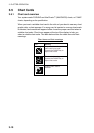
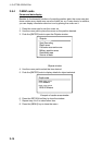
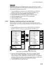
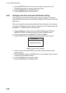
5. Press the DATE soft key to open the DATE window.
CHANGE DATE
(DAY. MONTH. YEAR)
01. 01. 2001
LIMIT: 31.12.2099
Date window
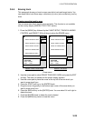
6. Use ◄ or ► to position the cursor where desired and then rotate the
[ENTER] knob to set. Repeat to enter complete date.
7. Push the [ENTER] knob to show the tidal graph for entered date.
8. Use ◄ or ► to locate the vertical cursor on the hour desired.
9. Use ▲ or ▼ to shift the level cursor to select draught.
10. See the time, height and draught indications below the tide graph for tide
information.
11. Press the RETURN soft key to close the TIDE window.
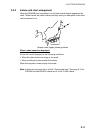
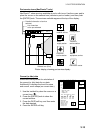
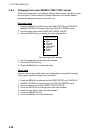
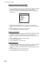
Port service icons
Selected C-MAP shows services available at
ports, with lists.
1. Use the trackball to place the cursor on
the sailboat icon (denotes a port or harbor)
desired.
2. Push the [ENTER] knob.
3. Select the service name desired. The
services available appear.
4. Press the CANCEL soft key.
C-map, port service display
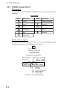
Objects
Port area
Port/Marine
Fuel station
Water
Electricity
Showers
Pubric toilets
Pubric telephone