


14. HOW TO MONITOR ROUTES
14-8
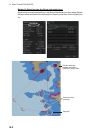
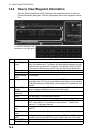
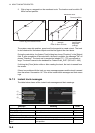
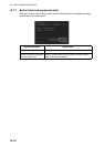
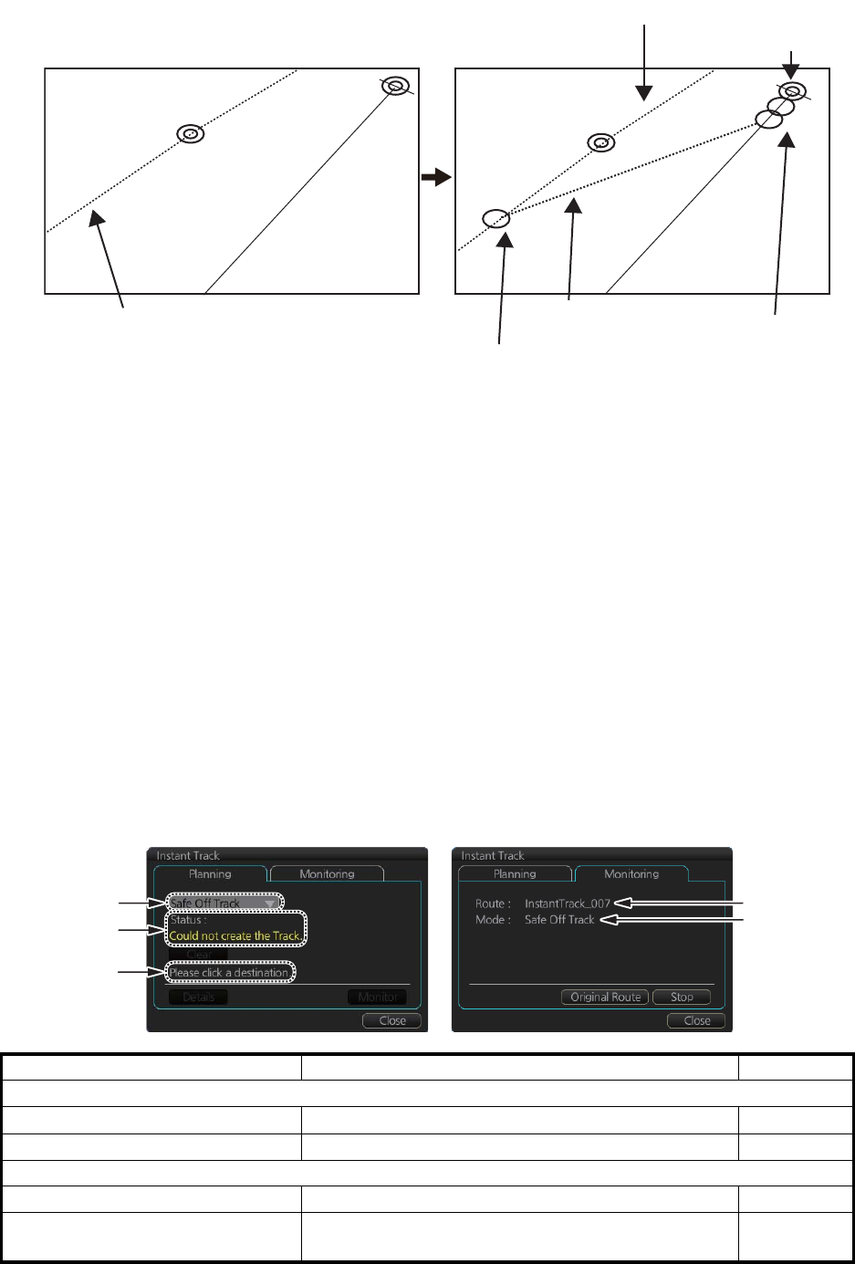
2. Click a leg or a waypoint on the monitored route. The location must be within 50
NM of current position.
The system uses ship position, speed and final waypoint to create a track. The track
is also checked for hazardous objects and the like against the chart alerts.
During the calculation, the [Instant Track] dialog box shows "Checking" in the [Status]
field. If, after completion of the calculation, the track is suitable, the message "OK" re-
places "Checking". The track and its waypoints, labeled [T1] - [T3], are colored or-
ange. The track is saved to the database as "InstantTrack_XXX" (XXX=001 - 400).
If clicking the [Clear] button while or after creating the track, the track is erased from
the screen.
If there is a problem with the track, an error message appears and the track is erased
from the screen. See section 14.7.3 for all the instant track messages and their mean-
ings.
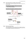
14.7.3 Instant track messages
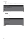
The table below shows all the instant track messages and their meanings.
Message Meaning Color
(1) Instant Track mode
"Back to Track" Back to track mode White
"Safe Off Track" Safe off track mode White
(2) Check result, error message
"Could not create the Track." The track could not be created. Yellow
"Too far destination from own
ship."
Selected destination is 50 NM or more from cur-
rent position.
Yellow
Current position
Monitored route
Click a leg on monitored route.
Instant track
(orange)
Instant track
waypoints
(orange)
Point of return to route
WPT2
WPT2
T1
T2
T3
(
1
)
(
2
)
(
3
)
(
1
)
(
4
)