190-00228-08 GPS 16x Technical Specifications Rev. B
Page 23
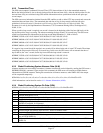
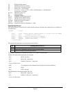
alt Ellipsoid altitude (meters)
epe Estimated position error (meters)
eph Position error, horizontal (meters)
epv Position error, vertical (meters)
fix 0 = no fix; 1 = no fix; 2 = 2D; 3 = 3D; 4 = 2D differential; 5 = 3D differential;
6 and greater = not defined
gps_tow GPS time of week (sec)
lat Latitude (radians)
lon Longitude (radians)
lon_vel Longitude velocity (meters/second)
lat_vel Latitude velocity (meters/second)
alt_vel Altitude velocity (meters/ second)
msl_hght height (mean sea level) (meters)
leap_sec UTC leap seconds
grmn_days Garmin days (days since December 31, 1989)
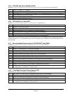
Satellite Data Record
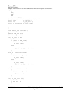
The satellite data has a record ID of 0x72 with 84 (0x54) data bytes. The data bytes contain data for 12 satellites as
described below.
typedef struct
{
uint8 svid; //space vehicle identification (1–32 and 33–64 for WAAS)
uint16 snr; //signal-to-noise ratio
uint8 elev; //satellite elevation in degrees
uint16 azmth; //satellite azimuth in degrees
uint8 status; //status bit-field
} cpo_sat_data;
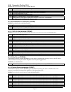
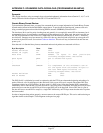
The status bit field represents a set of booleans described below:
Bit Meaning when bit is one (1)
0 The unit has ephemeris data for the specified satellite.
1 The unit has a differential correction for the specified satellite.
2 The unit is using this satellite in the solution.
This pattern is repeated for 12 satellites for a total of 12 X 7 bytes = 84 (0x54) bytes.
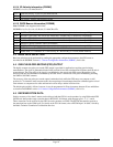
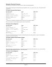
The RS-232 Packet for the Satellite Record looks like:
- 0x10 (DLE is first byte)
- 0x72 (Record ID – single byte)
- 0x54 (Number of data bytes – single byte)
- 12 cpo_sat_data records
- 0x## (2’s complement of the arithmetic sum of the bytes between the delimiters)
- 0x10 (DLE)
- 0x03 (ETX is last byte)
The USB Packet for the Satellite Record looks like:
- 0x72 (Record ID – single byte)
- 0x54 (Number of data bytes – single byte)
- 12 cpo_sat_data records


