


23
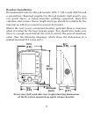
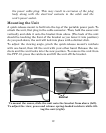
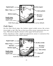
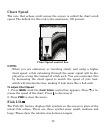
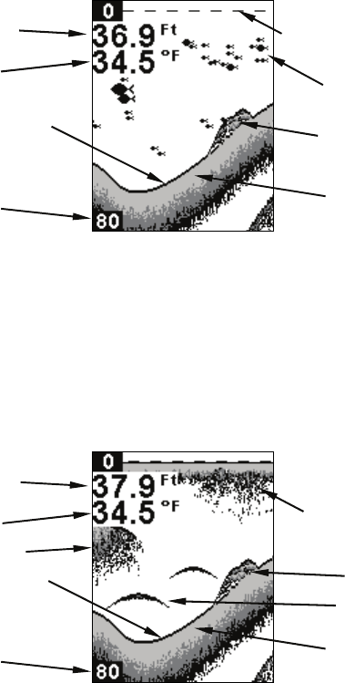
Full Chart page. Fish I.D. (fish symbols) is on by default.
Full Chart
On the Full Chart page, the bottom signal scrolls across the screen
from right to left. The line at the top of the screen represents the sur-
face. The bottom depth is shown in the upper left-hand corner.
If the transducer with a built-in temperature sensor is connected, the
water temperature also will be shown.
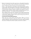
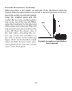
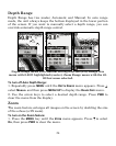
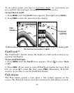
Full Chart page with Fish I.D. turned off.
Fish symbols
Grayline
®
Bottom signal
Digital depth
Depth range
at bottom of
de
p
th scale
Surface signal
Water Temp
Structure
or cove
r
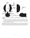
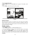
Gra
y
line
®
Fish arches
Bottom signal
Digital depth
Water Temp
Depth range
at bottom of
de
p
th scale
Surface clutter
Structure
or cove
r
Bait fish