20
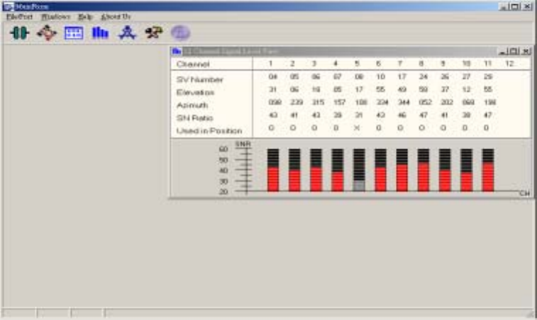
Figure 2.11 GPS satellite information.
2.2.7 Receiver Information
Figure 2.12 describes the receiver information. They are:
UTC Date: day/month/year;
UTC Time: hour:minute:second;
Lat: latitude xxyy.yyyy xx: degree, yy.yyyy: minute, -: southern hemisphere;
Lon: longitude xxxyy.yyyy xxx: degree, yy.yyyy: minute, -: western hemisphere;
Alt: altitude (meter);
SVs(Used/All): (number of satellites used for position calculation) / (number of the
observable satellites);
Mode: 2D or 3D position;
PDOP: Position Dilution Of Precision: geometry among the receiver and GPS
satellites;
Speed: module’s speed (knot);
True Course: module’s moving direction with respect to North (clockwise, degree);
Datum: type of coordinate frame (default: WGS 84);
GPS Quality: SPS or PPS mode, position fixed or not.
The sub-window is activated by two ways: clicking “Windows/Measured Navigation
Message View” or the shortcut button ?.


