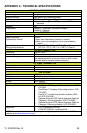
Y1-03-0250 Rev. B 27
APPENDIX B - THE COSPAS-SARSAT SYSTEM
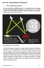
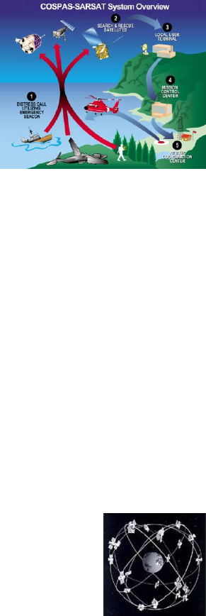
1. General overview
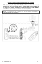
EPIRBs transmit to the satellite portion of the Cospas-Sarsat system. Cospas-Sarast
satellites are an international system that utilizes Russian Federation and United States’
low altitude, near-polar orbiting satellites (LEOSAR). These satellites assist in detecting
and locating activated 406 MHz satellite beacons.
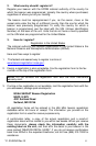
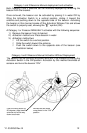
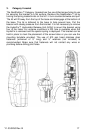
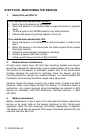
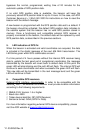
Cospas-Sarsat satellites receive distress signals
from EPIRBs transmitting on the frequency of
406 MHz. The Cospas-Sarsat 406 MHz beacon
signal consists of a transmission of non-
modulated carriers followed by a digital message
format that provides identification data. The 406
MHz system uses satellite-borne equipment to
measure and store the Doppler-shifted frequency
along with the beacon’s digital data message and
time of measurement. This information is
transmitted in real time to an earth station called
the Local User Terminal (LUT), which may be
within the view of the satellite, as well as being stored for later transmission to other
LUTs.
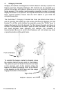
The LUT processes the Doppler-shifted signal from the LEOSAR and determines the
location of the beacon, then the LUT relays the position of the distress to a Mission
Control Center (MCC) where the distress alert and location information is immediately
forwarded to an appropriate Rescue Coordination Center (RCC). The RCC dispatches
Search and Rescue (SAR) forces.
The addition of the GEOSAR satellite system greatly improves the reaction time for a
SAR event. This satellite system has no Doppler capabilities at 406 MHz, but will relay the
distress alert to any of the LUT stations. When there is GPS data included in the distress
message, SAR authorities instantly know your location to within 110 yards (100 m). This
speeds up the reaction time by not having to wait for one of the LEOSAR satellite to pass
overhead. Because most of the search and rescue forces presently are not equipped to
home in on the 406 MHz Satellite beacons signal, homing must be accomplished at 121.5
MHz.
Once the 406 MHz signal is relayed through the LEOSAR and/or GEOSAR network, SAR
forces determine who is closest, and then proceed to the beacon using the 121.5 MHz
homing frequency.
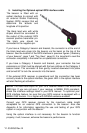
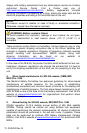
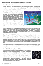
2. Global Positioning System (GPS)
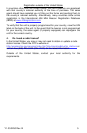
The GPS system is a satellite group that enables a GPS receiver to
determine its exact position to within 30 m (100 ft.) anywhere on
earth. With a minimum of 24 GPS satellites orbiting the earth at an
altitude of approximately 11,000 miles they provide users with
accurate information on position, velocity, and time anywhere in the
world and in all weather conditions. The GlobalFix™ iPRO stores
adds this data to its distress transmission, allowing search and
rescue forces to narrow the search to a very small area, thus
minimizing the resources required, and dramatically increasing
the effectiveness of the overall operation.