


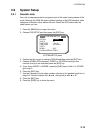

3. OPERATION
3-17
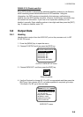
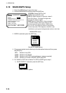
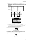
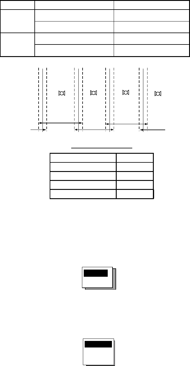
2) Use the Omnipad to choose WAAS satellite search method, AUTO or
MANUAL as appropriate. For MANUAL, press the [ENT] key, enter
appropriate WAAS satellite referring to the illustration below and then press
the [ENT] key.
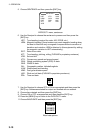
Provider GEO Satellite Longitude
POR (134) 178°E
WAAS
AOR-W (122) 54°W
AOR-E (120) 15.5°W
EGNOS
IOR (131) 64.5°E
122
AOR-W
54°W
120
AOR-E
15.5°W
131
IOR
64.5°W
134
POR
178°E
118°W 34.75°W 24.5°E 121.25°E
2°
2°
2° 2°
Longitude Range Satellite
120.25
°
E to 117
°
W 134
119
°
W to 33.75
°
W 122
35.75
°
W to 25.5
°
E 120
23.5
°
E to 122.25
°
E 131
One-degree threshold
GEO satellite and coverage area
3) CORRECTIONS DATA SET is selected; press the [ENT] key.
CORRECTIONS DATA SET determines how to use the WAAS signal, which
is currently in the test mode. Use the default setting (02) until the WAAS
system becomes operational, then change the setting to “00.”
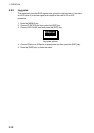
6. Choose DPGS STATION and press the [ENT] key.
AUTO
MANUAL
AUTO/MANUAL options
7. Choose MANUAL or AUTO as appropriate and press the [ENT] key. For
AUTO got to step 8. For MANUAL do the following:
1) RATE is selected; press the [ENT] key.
50BPS
100BPS
200BPS
Baud rate options