


3
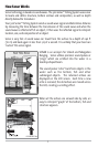
DualBeam PLUS
TM
Sonar
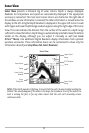
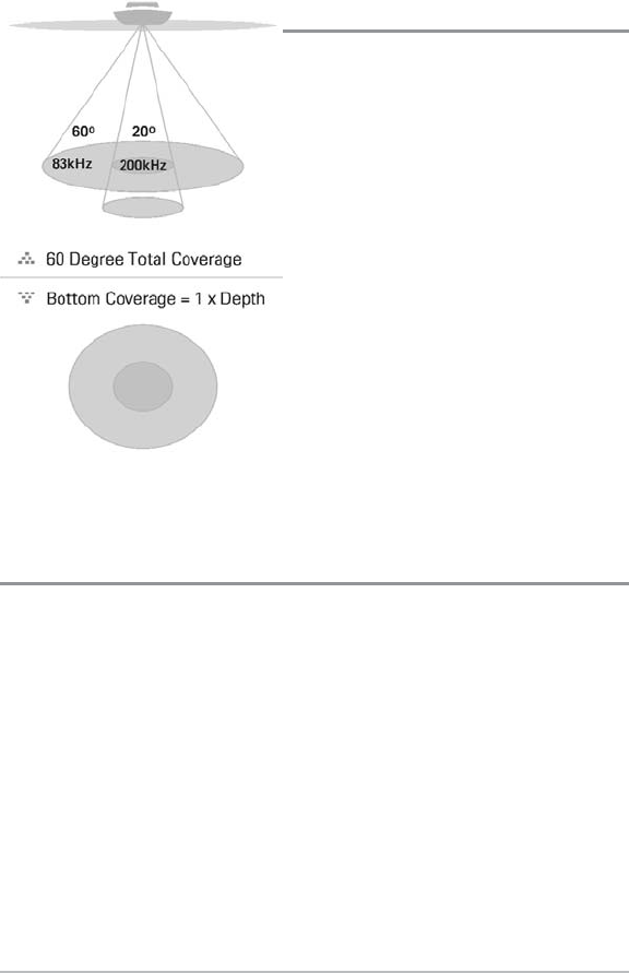
Your 300 Series
TM
Fishing System uses a 200/83
kHz DualBeam PLUS
TM
sonar system with a
wide (60°) area of coverage. DualBeam PLUS
TM
sonar has a narrowly focused 20° center beam,
surrounded by a second beam of 60°,
expanding your coverage to an area equal to
your depth. In 20 feet of water, the wider beam
covers an area 20 feet wide. The 20° center
beam is focused on the bottom, to show you
structure, weeds and cover. The 60° wide beam
is hunting for fish in the wide coverage area.
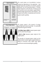
DualBeam PLUS
TM
sonar returns can be blended
together, viewed separately or compared side-
by-side. DualBeam PLUS
TM
is ideal for a wide
range of conditions - from shallow to very deep
water in both fresh and salt water. Depth
capability is affected by such factors as boat
speed, wave action, bottom hardness, water
conditions and transducer installation.
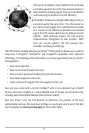
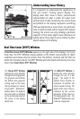
How GPS and Cartography Work
Your 300 Series
TM
Fishing System also supports GPS and chartplotting, and uses GPS and
sonar to determine your position, display it on a grid, and provide detailed underwater
information. The Global Positioning System (GPS) is a satellite navigation system
designed and maintained by the U.S. Department of Defense. GPS was originally
intended for military use; however, civilians may also take advantage of its highly
accurate position capabilities, typically within +/- 10 meters, depending on conditions.
This means that 95% of the time, the GPS receiver will read a location within 10 meters
of your actual position. Your GPS Receiver also uses information from WAAS (the Wide
Area Augmentation System), EGNOS (the European Geostationary Navigation Overlay
Service), and MSAS (the MTSAT Satellite Augmentation System) satellites if they are
available in your area.