


D8809_2
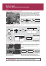
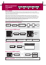
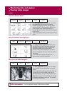
How do I view target information?
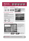
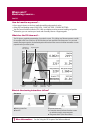
How do I view detailed AIS data?
What is around me?
Using AIS
Card 16
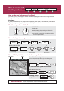
AIS uses digital radio signals to broadcast ‘realtime’
information between vessels and shore based stations
via dedicated VHF frequencies. This information is used
to identify and track vessels in the surrounding area and
to provide collision avoidance data. AIS will augment
your radar application, as it can operate in radar blind
spots.
In order to use the AIS feature, you will need a GPS and
compass for timing and position information together
with data from a suitable AIS receiver.
AIS VECTOR
ON OFF
AIS DATA
AUTO ON OFF
VIEW FULL
AIS DATA
125
o
T
7.7kt
01.30nm
12h15m30s
VIEW FULL
AIS DATA
--,---nm
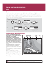
MNSI
Name
Call sign
Last seen
Lat
Lon
Hdg
Length
Beam
Draught
COG
SOG
CPA
TCPA
IMO No
Dest
Status
Type
ETA
6
Sim Target 6
01/01/2006 01:13:21AM
30 39’.702W
O
AIS Target info: Sim Target 6
080o18'.702W
159oT
142oT
25,7kt
--,---nm
Under Way Using Engine
Normal
--h--m--s
--,---ft
--,---ft
--ft
--/--/---- --:--:--AM
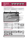
What is AIS?
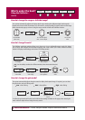
PRESENTATION...
PRESENTATION...
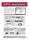
Toggle as required
On chart windows:
On radar windows:
Toggle as required
CHART LAYERS...
AIS LAYER
ON OFF
AIS LAYER
ON OFF
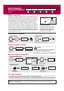
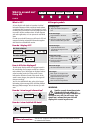
How is AIS data displayed?
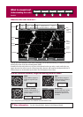
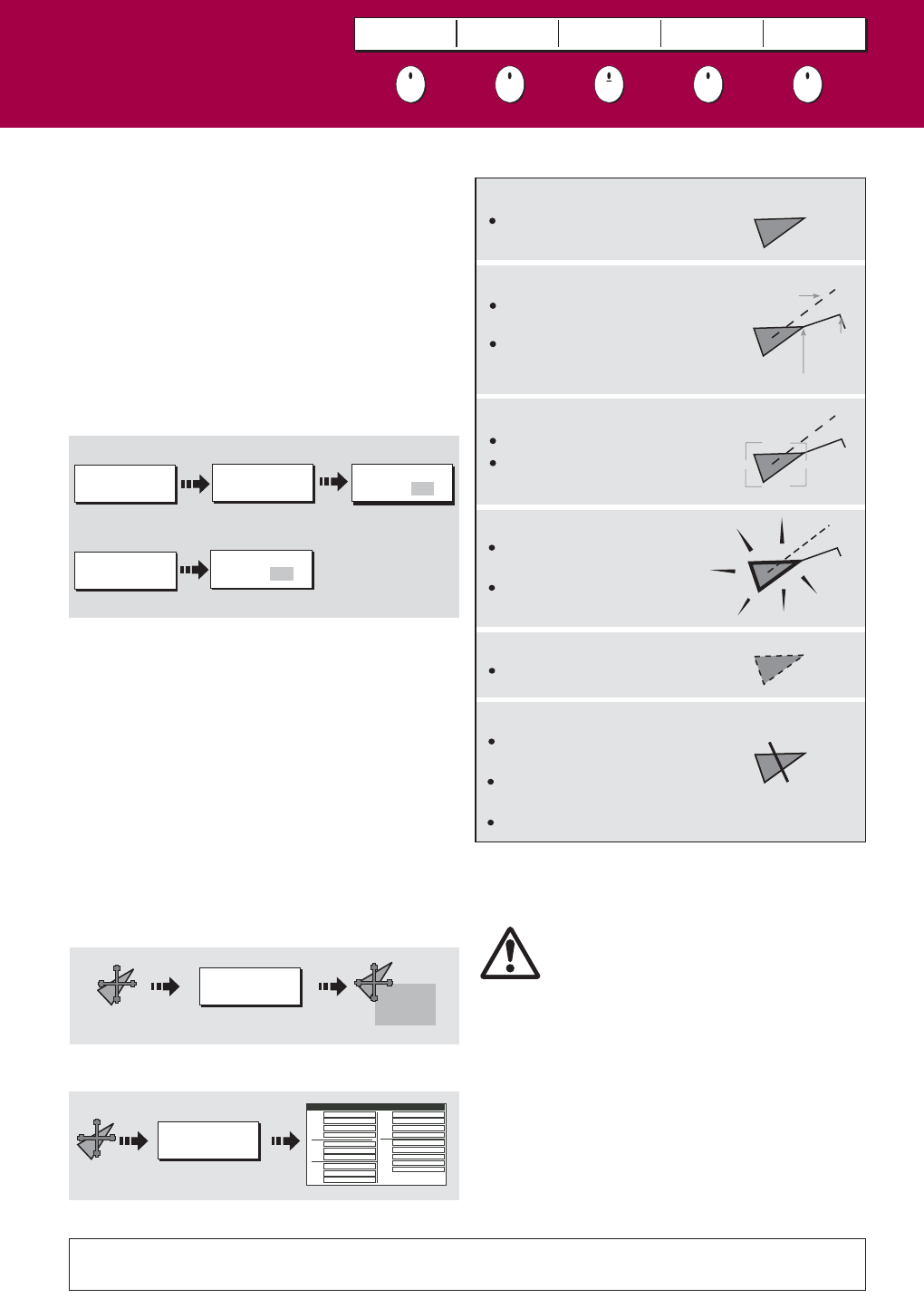
Selected target
Dangerous target
Targets within specified distance
(CPA) or time (TCPA).
Dangerous target alarm sounds
and target flashes.
Activated target
Target activated i.e. AIS vector
displayed.
Vector line (optional) shows predicted
distance travelled within given time.
Uncertain target
Calculated CPA/TCPA value uncertain.
AIS target symbols
Lost target
When signal of a dangerous AIS
target not received for 10 seconds.
Target orientated in COG or CSE
direction as appropriate.
Alarm sounds and target flashes
COG/SOG
vector
Heading
Direction
of turn
See the 'AIS' chapter of the reference manual for data classes and how
to customise this feature.
Target selected with cursor.
Can activate the target and view
detailed data.
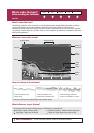
WARNING:
The AIS system displays other AIS equipped vessels in
the surrounding area as targets overlaid on a chart or
radar window. Up to 100 targets are displayed and are
scaled according to the size of the vessel. A vector
indicates the direction of travel of the vessel. As the
vessel’s status changes, the symbol for the target will
change accordingly.
You can view detailed AIS data, safety critical target
information, Alarm message (ALR) and Safety Related
Message (SRM) messages. You can also set up a safe
zone.
Sleeping target
Target not activated, dangerous or
lost.
AIS
AIS DATA
AUTO ON OFF
Smaller vessels do not have to be
fitted with AIS and whilst it is
mandatory for larger commercial
vessels to carry AIS, its use is not. You
should not assume that your AIS will
display ALL vessels in your area.
?
More information...
How do I display AIS?