


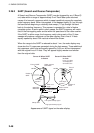
3. PLOTTER OPERATION
3-5
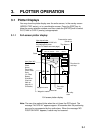
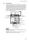
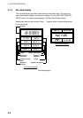
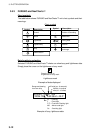
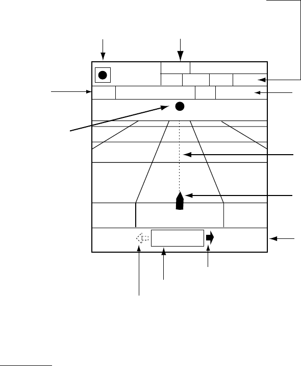
3.1.3 Highway display
The highway display, displayed at the lower half of the screen in the combination
display, provides a graphic presentation of ship’s track along intended course. It
is useful for monitoring ship’s progress toward a waypoint. The own ship marker
shows relation between ship and intended course. The XTE monitor shows the
direction and amount your vessel is off course – the arrow shows the direction to
steer to return to your course and the numeric the distance you are off course.
Using the figure below as an example, you would steer right 0.009 nm to return
to course. To maintain course, steer the vessel so the own ship marker stays
aligned with the intended course line.
Time-to-go
to destination
Range to
destination waypoint
Estimated time of
arrival at destination
0.9 nm
WPT001
003WPT
0D 9H 59M
TTG 23th23:59
ETA
SOG
10.0
kt
10.0
kt
STW
RNG
99.9 nm
Destination
waypoint
Own ship marker
Speed over ground, speed through water
XTE monitor
0.009nm
0.9 nm
XTE range
Intended
course
Destination waypoint
Direction to steer (green on color model)
Shown (in red on color model) when
direction to steer is "left."
Highway display
Soft keys
EDIT XT-LMT: Sets the range for the XTE monitor scale. See the procedure on
the previous page for how to set.
RESET XTE: Displayed when destination is set, and enables you to restart
navigation. See the description on the previous page.