1. OPERATIONAL OVERVIEW
3
1.4 Display Modes
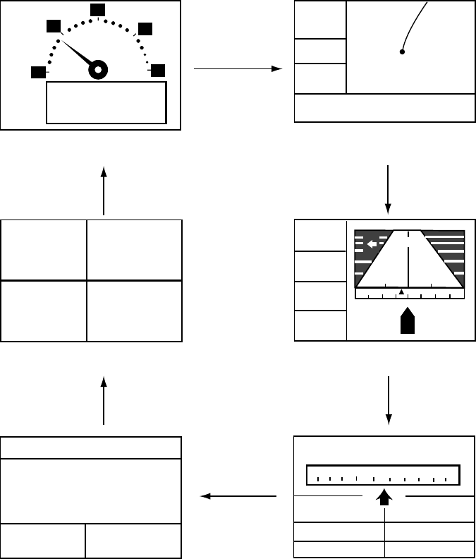
Your unit has five display modes: Plotter Display, Highway Display, Steering Display, Nav Data
Display and User Display (digital data and speedometer). Press the [DISP] key to choose a
display mode. Each time the key is pressed, the display mode changes in the sequence shown
below.
[Highway Display]
COG
BRG
RNG
SOG
0.5
XTE
0.05
242°
0.05 0.05
17.5
004
n
m
[Plotter Display]
D2D
[ 5 ]
n
m
SOG:
10.0
k
t
34°44.000N 135°21.000E
X
D2D MAG 15:37
NE
30 60
300 330
SOG:
kt
COG:
RNG:
BRG:
TTG:
ETA:
1H30M 12:30
17.5 nm
242°
[Steering Display]
(Display format
depends on user setting.)
CURSOR
[+]
n
m
k
t
[Nav Data Display]
D2D
02-FEB-02 15:37:40
SOG:
kt
COG:
34°44. 000'
N
135°21. 000'
E
10.0 357°
COG:
357°
357°
10.0
10.0
357
°
[User Display: Speedometer]
(Display format
depends on user setting.)
20
30
40
60
0
10
0
9.9
KT
SOG
[User Display: Digital Data]
POWER(V) SOG(KT)
TRIP(NM) COG(°)
9.99 5.6
12.1 9.9
[DISP] key
[DISP] key
[DISP] key
[DISP] key
[DISP] key
[DISP] key
Display modes (default user displays)
Note 1: The unit measures distances up to 9999 nm. Any distance greater than 9999 nm is
shown as “*999”.
Note 2: Position data can be shown in latitude and longitude or TDs (Loran C or Decca).


