


11. CHART ALERTS
11-5
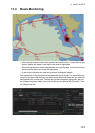
11.3 Route Planning
The system will calculate chart alerts using user-defined channel limit for routes. Dan-
ger areas are shown highlighted if safety contour or user-chosen chart alert areas are
crossed by the planned route. For more information on route planning, see chapter 12.
Note: If your voyage is going to take a long time or you are planning it much earlier
than it is to take place, use the Display date and Approved until dates corresponding
to the dates you are going to sail.
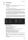
11.3.1 Chart alerts for route planning
You can generate a list of chart alerts that cross by the planned route. This can be
done as follows:
1. Enter safety contour you want to use.
2. Plan a route; define waypoints and other necessary information. See chapter 12
for route planning.
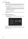
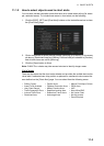
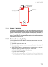
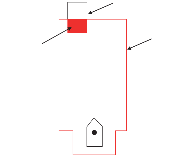
3. Select dangerous objects to be monitored during route monitoring, on the [Alert
Parameters] page in the [Route Plan] dialog box, shown below.
a) Click the [PLAN], [Planning] and [Route] buttons.
b) Click the [Alert Parameters] tab.
c) Click the alert to process. Show a red circle for visual and aural alerts, or yel-
low circle for visual alert. Note that the safety contour is always shown in red.
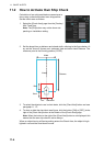
Highlight (red)
Object selected
for Chart Alert
Check Area