


GPSMAP
®
2008/2108 Owner’s Manual 7
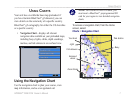
Us i n g Ch a r T s
Us i n G Ch a r T s
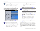
Your unit has a worldwide base map preloaded. if
you have Garmin BlueChart
®
g2 datacard, you can
viewdetailsonthewaterwalyofaspeciccountry.
BlueChart
®
g2 cartography for either the US shoreline
oraspeciccountry.
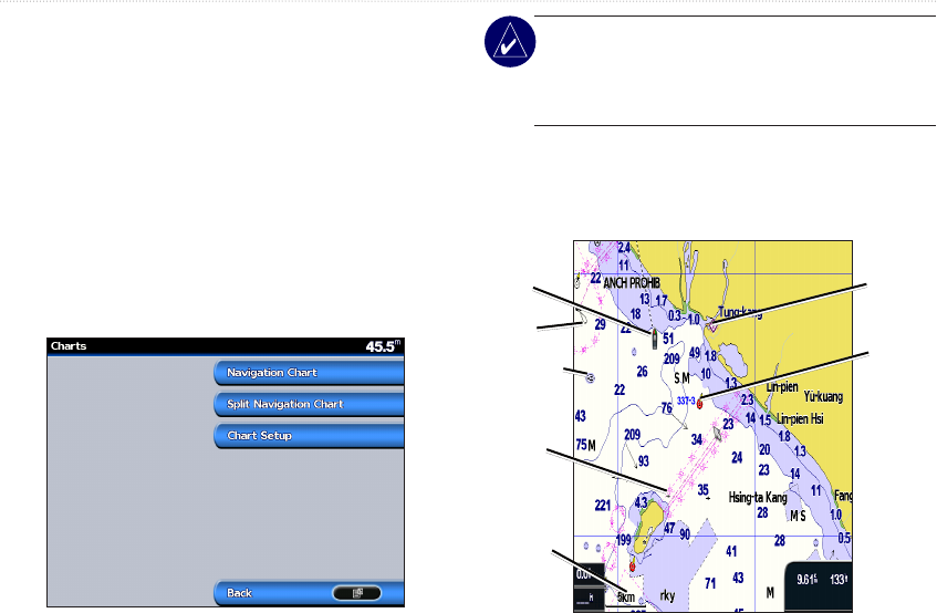
•
Navigation Chart—displays all relevant
navigation data available on your preloaded maps,
including buoys, lights, cables, depth soundings,
marinas, and tide stations in an overhead view.
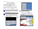
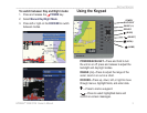
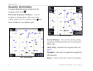
Using the Navigation Chart
Use the navigation chart to plan your course, view
map information, and as a navigational aid.
NOTE: For GPSMAP 2008/2108 units, you
must insert a BlueChart
®
preprogrammedSD
card for your region to view detailed navigation
charts.
To access a navigation chart, from the Home
screen, select
Charts > Navigation Chart.
Light
Exposed
wreck
Your boat
Zoom Scale
Tide station
Navigation Chart with g2
Buoy
Fish Heaven