


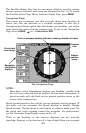

103
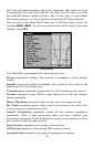
Background map vs. MapCreate map content
The background map includes: low-detail maps of the whole world
(containing cities, major lakes, major rivers, political boundaries); and
medium-detail maps of the United States.
The medium-detail U.S. maps contain: all incorporated cities; shaded
metropolitan areas; county boundaries; shaded public lands (such as
national forests and parks); some major city streets; Interstate, U.S.
and state highways; Interstate highway exits and exit services
information; large- and medium-sized lakes and streams; and more
than 60,000 navigation aids with 10,000 wrecks and obstructions in
U.S. coastal and Great Lakes waters
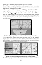
MapCreate custom maps include massive amounts of information not
found in the background map. MapCreate contains: Points of Interest
database, all the minor roads and streets, all the landmark features
(such as summits, schools, radio towers, etc.); more rivers, streams,
smaller lakes and ponds and their names.
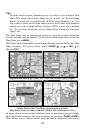
What's more important is the large scale map detail that allows your
GPS unit to show a higher level of position accuracy. For example, the
background map would show you the general outline and approximate
shape of a coastline or water body, but the higher detail in MapCreate
shows the shoreline completely and accurately. Many smaller islands
would not be included in the background map, but are in MapCreate.
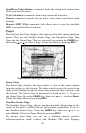
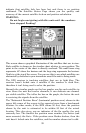
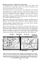
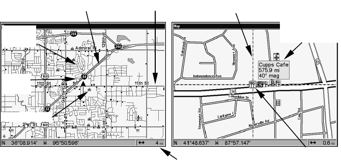
When the map is zoomed out far enough, most POIs appear as square
dots. As you zoom in closer, the symbols become readable icons. In the
0.6 mile zoom example (right), the cursor has selected the Cupps Café
POI, which triggers a pop-up box with the POI name. This pop-up box
works on POIs at any zoom range.
School POI
POI Pop-up,
with position,
distance and
bearing data
Restaurant
POI
POI
Mar
k
er
Cursor lineInterstate Major Street
Minor
Streets
Zoom Range