66
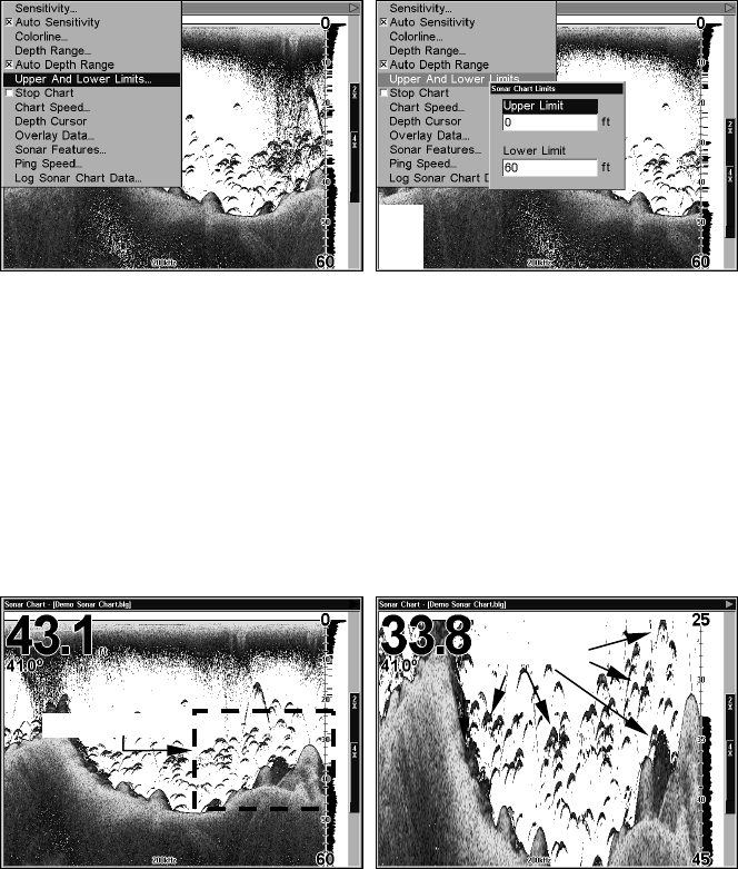
Sonar Page Menu with Upper and Lower Limits command selected
(left); Sonar Chart Limits menu, with Upper Limit selected (right).
To change the upper and lower limits:
1. From the Sonar Page, press
MENU|↓ to UPPER AND LOWER LIMITS|ENT.
The Sonar Chart Limits menu appears, with Upper Limit selected.
2. To set the upper limit, press
ENT. Press ↑ or ↓ to change the first
number, then press → to move the cursor to the next number and
repeat until the depth is correct, then press
EXIT.
3. To set the lower limit, press ↓ to
LOWER LIMIT|ENT. Press ↑ or ↓ to
change the first number, then press → to move the cursor to the next
number and repeat until the depth is correct, then press
EXIT|EXIT|EXIT.
Normal display, in auto depth range mode, (left); Display "zoomed" with
Upper and Lower Limits focusing on the portion of the water column
from 25 feet to 45 feet deep (right). In the "zoomed" image on the right,
note the target definition, showing two fish holding just off the structure.
To turn off upper and lower limits:
From the Sonar Page, press
MENU|↓ to AUTO DEPTH RANGE|ENT|EXIT.
FasTrack
This feature automatically converts all echoes to short horizontal lines
on the display's far right side. The graph on the rest of the screen
continues to operate normally. FasTrack gives you a rapid update of
Area "zoomed"
