


33
Reference Manual
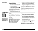
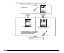
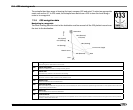
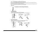
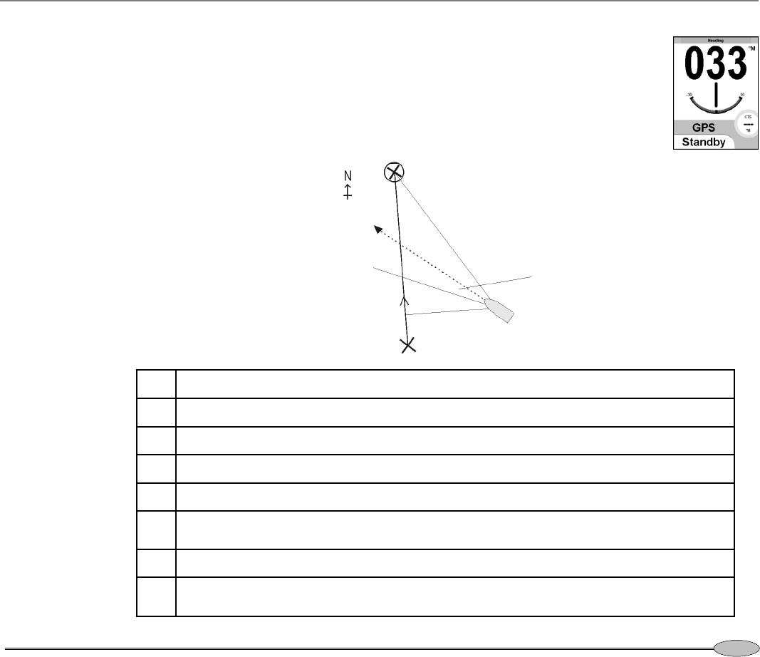
Destination
DTG (distance)
TTG (time)
BRG (bearing)
SOG (speed)
Course error (angle)
CTS (bearing)
Plotted course
Boat
XTE (distance)
Start
COG (bearing)
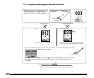
The autopilot has three ways of steering the boat, compass, GPS and wind. To select an appropriate
mode, see section 3-7. In GPS mode, the autopilot uses data from a GPS to steer the boat along a
route or to a waypoint.
7-2-1 GPS navigation data
Navigating to a waypoint:
The boat is sailing from the start to the destination and has moved off the GPS plotted course from
the start to the destination:
BRG
Bearing to destination
The bearing to the destination from the boat.
COG Course over ground
Direction in which the boat is moving over the ground.
CE
Course error
The difference between CTS and the boat heading.
CTS
Course to steer
Optimum course to steer to return to the plotted course.
DTG Distance to go
Distance from the boat to the destination.
SOG Speed over ground
The current boat speed over the ground. This is not necessarily the same as the boat speed through the water nor the speed at which the boat
is approaching the destination.
TTG Time to go
The estimated time to reach the destination.
XTE
Cross track error
The distance from the boat to the nearest point of the plotted course. XTE may have a letter: R means steer to the right to return to the plotted
course, L means steer to the left.
7-2 GPS steering mode