


145
check to select the level of map detail you prefer. Use ↑ ↓ to choose off,
low, medium or high, then press
EXIT to the page display.
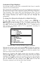
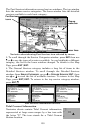
Pop-up Map Info
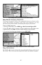
From the Map Page, press
MENU|↓ to MAP DATA|ENT. Press ↓ to POPUP
MAP INFO. With the option highlighted, press ENT to check it (turn on)
and uncheck it (turn off.) After the option is set, press
EXIT|EXIT to
return to the page display.
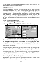
Draw Map Boundaries
From the Map Page, press
MENU|↓ to MAP DATA|ENT. Press ↓ to DRAW
MAP BOUNDARIES. With the option highlighted, press ENT to check it (turn
on) and uncheck it (turn off.) After the option is set, press
EXIT|EXIT to
return to the page display.
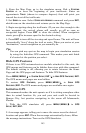
Fill Water with White
From the Map Page, press
MENU|↓ to MAP DATA|ENT. Press ↓ to FILL
WATER WITH WHITE. With the option highlighted, press ENT to check it
(turn on) and uncheck it (turn off.) After the option is set, press
EXIT|EXIT to return to the page display.
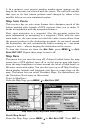
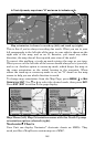
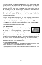
Trackline Extension
Trackline Extension is a tracking option that provides a visual
interpretation of your velocity. It charts how long it will take to travel a
predetermined distance based on your current navigational
information. Distance is shown on one side of the track with estimated
time of arrival on the other. Below the Trackline Extension window are
two check boxes — Show Time and Show Distance — which allow you
to turn on or off the time and/or distance settings.
To set trackline extension: From the Map Page, press
MENU|↓ to
MAP DATA|ENT. Press ↓ to TRACKLINE EXTENSION|ENT. Use ↑ ↓ to select the
desired distance setting and press
ENT.
Presentation Mode
From the Map Page, press
MENU|↓ to MAP DATA|ENT. Press ↓ and → to
PRESENTATION MODE|ENT. Use ↑ ↓ to choose the desired depth and press
ENT. PRESENTATION MODE gives you some control over the map layout by
allowing you to choose between US and International Modes
.
Safety Contour
From the Map Page, press
MENU|↓ to MAP DATA|ENT. Press ↓ and → to
SAFETY CONTOUR|ENT. Use ↑ ↓ to choose the desired depth and press ENT.
The SAFETY CONTOUR command allows you to modify depth contours on a
navionics map for water less than 10 meters deep. Based on your
preferences, the depth contours will be colored or shaded to make it
easier to identify shallow areas. Keep in mind the size of your ship's
keel when determining which option is right for your vessel.