


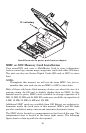
46
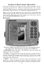
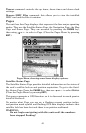
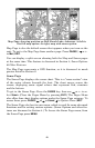
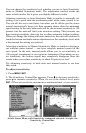
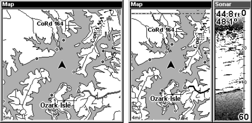
Map Page, showing position on Bull Shoals Lake, Arkansas. At left is
the full map option. At right, map with sonar option.
Map Page is also the default screen that appears when you turn on the
unit. To get to the Map Page from another page: Press
PAGES| → or ←
to
MAP|EXIT.
You can display a split screen showing both the Map and Sonar pages
at the same time. This feature is discussed in Section 4, Sonar Options
& Other Features.
The Map Page represents a GPS function, so it is discussed in much
greater detail in Section 6.
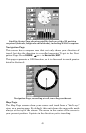
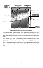
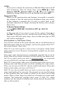
Sonar Page
The Sonar Page displays the sonar chart. This is a "cross-section" view
of the water column beneath the boat. The chart moves across the
screen, displaying sonar signal echoes that represent fish, structure
and the bottom.
To get to the Sonar Page: Press the
PAGES key, then use → or ← to se-
lect
SONAR. (Clear the Pages Menu by pressing EXIT.) The Pages Menu
also offers four chart display options under the Sonar Page category. To
access them, press
PAGES|← or→ to SONAR|↓ to Option Name|EXIT.
The Sonar Page also has its own menu, which is used for some advanced
functions and for setting various options. (Sonar Options and other fea-
tures are discussed in Section 4.) To Access the Sonar Page menu, from
the Sonar Page press
MENU.