


3-1
3. PLOTTER OPERATION
3.1 Plotter Displays
You may show the plotter display over the entire screen, in the overlay screen
(MODEL1722C series), or in a combination screen. Press the [DISP] key to
show the screen selection window, and then rotate the [ENTER] knob to select
PLOT, NAV or OVRLY (overlay) as appropriate.
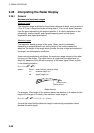
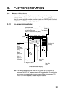
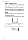
3.1.1 Full-screen plotter display
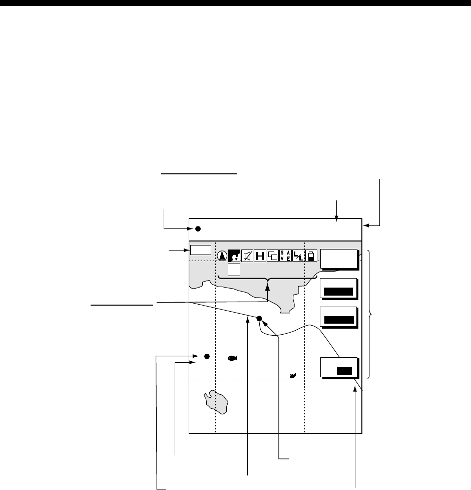
BRIDGE
FISH
002WP
34° 22. 3456'N 359.9°
M
TRIP
NU
080° 22. 3456'E
19.9 kt 99.9 nm
MODE
NTH UP
NAV
POS
MARK
ENTRY
D. BOX
ON/OFF
16.0nm
S
I
M
Nav data window
(Data changes with NAV soft
key setting and cursor
status. For details see next page.)
Course bar
Functions for
soft keys
Own ship
track
Own ship
marker
Presentation mode
(North-up)
Icon (from left)
North Marker
Chart
Alarm
Track Hold
Chart Offset
Save
L/L Offset
Battery
Simulation
(See icon
table on
page A-14
for details.)
Waypoint name
Waypoint marker
Scale
Trip distance
Full-screen plotter display
Note: The own ship marker blinks when the unit loses the GPS signal. The
message “No GPS fix!” appears approx. 90 seconds after the positioning
error and is accompanied by the audio alarm. When the message “NO
POSITION DATA” appears, a cable may be loosened.