


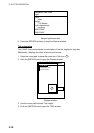
3. PLOTTER OPERATION
3-12
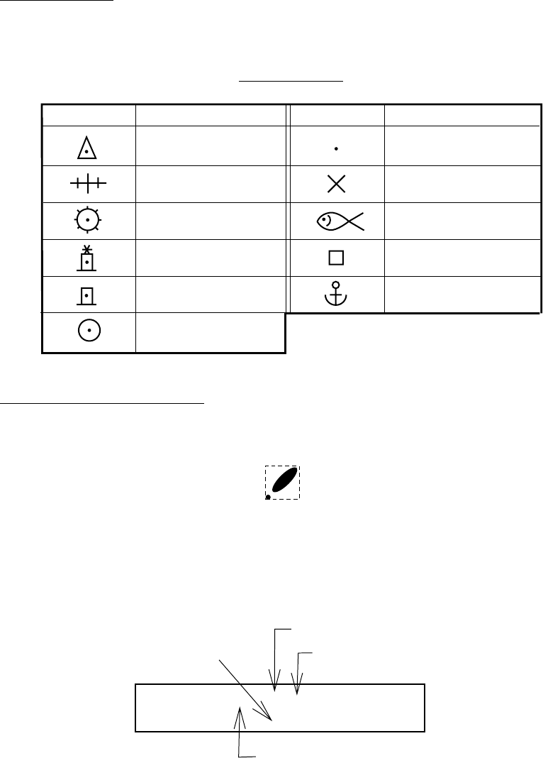
3.5.3 FURUNO and NavCharts
™
Chart symbols
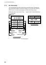
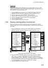
The table below shows FURUNO and NavCharts
™
mini chart symbols and their
meanings.
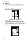
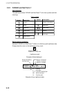
Chart symbols
Symbol Description
Summit
Wreck
Lighthouse
Lighted Buoy
Buoy
Radio Station
Symbol Description
Position of Sounding
Obstruction
Fishing Reef
Platform
Anchorage
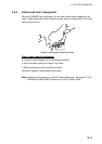
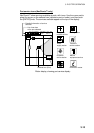
Data for aids to navigation
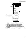
Selected FURUNO and NavCharts
™
charts can show buoy and lighthouse data.
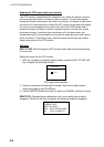
Simply place the cursor on the lighthouse or buoy mark.
Place the cursor on
a lighthouse or buoy mark.
Lighthouse mark
NAVAID: /FL 6S 12M
FROM OS 52.38nm 48.0°
Period (ex.: 6 seconds)
Visibility in nautical
mile (ex.: 12 miles)
FL : Flashing
F : Fixed light
F FL : Fixed and Flashing light
MO : Morse code light
Oc : Occulting light
Example of data displayed
Range and bearing
from own ship
Example of buoy, lighthouse data