


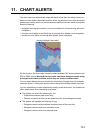
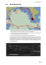

11. CHART ALERTS
11-3
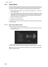
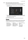
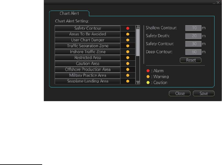
11.1.2 How to select objects used in chart alerts
You can also include calculation areas that have to be noted when sailing (for exam-
ple, restricted areas). To include these areas in chart alerts, do the following:
1. Click the [DISP], [SET] and [Chart Alert] buttons on the InstantAccess bar to show
the [Chart Alert] page.
2. Click a checkmark to select the alert choice ([Warning] or [Caution]). In the exam-
ple above, [Restricted Area] and [Military Practice Area] are selected to [Caution]
and all other times are set for [Warning].
3. Click the [Save] button to finish.
Note: C-MAP Pro+ charts may take several minutes to identify danger areas.
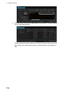
List of areas
There are the areas that the chart radar detects and provides the audible alert and/or
visual alert if estimated own ship position or planned or monitored route crosses the
area defined on the [Chart Alert] page. You can select from the following areas:
• Safety Contour
• Areas To Be Avoided
• User Chart Danger
• Traffic Separation Zone
• Inshore Traffic Zone
• Restricted Area
• Caution Area
• Offshore Production Area
• Military Practice Area
• Seaplane Landing Area
• Submarine Transit Lane
• Anchorage Area
• Marine Farm/Aqua Culture
• PSSA Area
• UKC
• Non-official ENC
• No Vector Chart
• Not Up-to-date
• Permit Expired