


13. USER CHARTS
13-2
areas as defined by the master or by the policy of the ship's owner. They are always
available regardless of the type of chart material used.
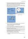
• Circle: The operator can define an area with a circle, which can define a location to
avoid. If route or estimated ship position is going to cross the area, the system gen-
erates a warning to the user. These areas can be used to specify safe areas as de-
fined by the master or by the policy of the ship's owner. They are always available
regardless of the type of chart material used.
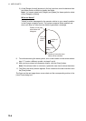
• Label: There are two types of labels: point and label. A "point" (i) is mainly used to
denote position of objects, such as buoys, light houses, fixed targets, wrecks, etc.
Points can be used in chart alert calculation. A "label" provides user-entered text to
show on the display.
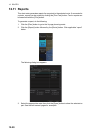
13.2 How to Create a User Chart
You can create and modify a user chart in the Voyage planning mode.
To make a complete user chart, do the following:
1. Click the [PLAN] button on the Status bar to go to the Voyage planning mode.
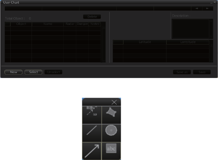
2. Click the [Planning] and [User Chart] buttons on the InstantAccess bar to show the
user chart palette and the [User Chart] dialog box.
3. Click the [New] button on the [User Chart] dialog box to create a new chart.
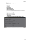
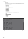
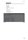
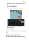
4. Click the desired object (button) on the palette.The [Tidal], [Line], [Clearing line]
and [Label] buttons have multiple choices. Right-click the respective button to
show a context sensitive menu. The choices available for each object are shown
below.
Tidal: Current, Predicted
Line: Coast, Nav, Route, Depth
Clearing line: NMT (Not More Than), NLT (Not Less Than)
Label: Label, Point
Tidal
Line
Clearing
line
Area
Circle
Label