


Table of Contents
Introduction.................................................................... 1
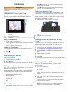
GPSMAP 8000 Series Front View............................................. 1
Using the Touchscreen......................................................... 1
Locking the Touchscreen...................................................... 1
Downloading the Manuals..........................................................1
Getting More Information........................................................... 1
Tips and Shortcuts..................................................................... 1
Inserting a Memory Card........................................................... 1
Loading the New Software on a Memory Card.......................... 1
Updating the Device Software................................................... 1
GPS Satellite Signals................................................................. 2
Selecting the GPS Source.................................................... 2
Stations and Home Screens...................................................... 2
Customizing the Home Screen............................................. 2
Resetting the Station Layouts............................................... 2
Using the Garmin Helm™ Application with the Chartplotter...... 2
Setting the Vessel Type............................................................. 2
Customizing the Layout of a Page............................................. 2
Adjusting the Backlight...............................................................2
Adjusting the Color Mode...........................................................2
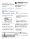
Charts and 3D Chart Views........................................... 2
Navigation Chart and Offshore Fishing Chart............................ 3
Zooming In and Out Using the Touchscreen........................ 3
Measuring a Distance on the Chart.......................................3
Chart Symbols.......................................................................3
Showing a Different Chart..................................................... 3
Viewing Location and Object Information on a Chart............ 3
Viewing Details about Navaids..............................................3
Navigating to a Point on the Chart........................................ 3
Premium Charts......................................................................... 4
Viewing Tide Station Information.......................................... 4
Animated Tide and Current Indicators..............................4
Showing and Configuring Tides and Currents..................4
Showing Satellite Imagery on the Navigation Chart.............. 4
Viewing Aerial Photos of Landmarks.................................... 5
Automatic Identification System................................................. 5
AIS Targeting Symbols......................................................... 5
Heading and Projected Course of Activated AIS Targets..... 5
Showing AIS and MARPA Vessels on a Chart or on a 3D
Chart View.............................................................................5
Activating a Target for an AIS Vessel................................... 5
Viewing Information about a Targeted AIS Vessel........... 5
Deactivating a Target for an AIS Vessel.......................... 6
Viewing a List of AIS and MARPA Threats........................... 6
Setting the Safe-Zone Collision Alarm.................................. 6
AIS Distress Signals..............................................................6
Navigating to a Distress Signal Transmission.................. 6
AIS Distress Signal Device Targeting Symbols................6
Enabling AIS Transmission Test Alerts............................ 6
Turning Off AIS Reception.................................................... 6
Chart and 3D Chart View Settings............................................. 6
Navigation and Fishing Chart Setup..................................... 6
Waypoints and Tracks Settings on the Charts and Chart
Views.....................................................................................7
Chart Appearance Settings................................................... 7
Other Vessels Settings on the Charts and Chart Views........7
Laylines Settings................................................................... 7
Fish Eye 3D Settings.............................................................7
Waypoints, Routes, and Tracks....................................7
Waypoints.................................................................................. 7
Marking Your Present Location as a Waypoint..................... 7
Creating a Waypoint at a Different Location......................... 7
Marking an SOS Location..................................................... 7
Viewing a List of all Waypoints
..............................................8
Editing a Saved Waypoint..................................................... 8
Moving a Saved Waypoint.................................................... 8
Browsing for and Navigating to a Saved Waypoint............... 8
Deleting a Waypoint or an MOB............................................8
Deleting All Waypoints.......................................................... 8
Routes........................................................................................8
Creating and Navigating a Route From Your Present
Location.................................................................................8
Creating and Saving a Route................................................ 8
Viewing a List of Routes........................................................8
Editing a Saved Route.......................................................... 8
Browsing for and Navigating a Saved Route........................ 9
Browsing for and Navigating Parallel to a Saved Route....... 9
Deleting a Saved Route........................................................ 9
Deleting All Saved Routes.................................................... 9
Tracks........................................................................................ 9
Showing Tracks.....................................................................9
Setting the Color of the Active Track.....................................9
Saving the Active Track........................................................ 9
Viewing a List of Saved Tracks............................................. 9
Editing a Saved Track........................................................... 9
Saving a Track as a Route.................................................... 9
Browsing for and Navigating a Recorded Track....................9
Deleting a Saved Track......................................................... 9
Deleting All Saved Tracks................................................... 10
Retracing the Active Track.................................................. 10
Clearing the Active Track.................................................... 10
Managing the Track Log Memory During Recording.......... 10
Configuring the Recording Interval of the Track Log...........10
Synchronizing User Data Across the Garmin Marine Network 10
Deleting All Saved Waypoints, Routes, and Tracks.................10
Navigation with a Chartplotter....................................10
Basic Navigation Questions..................................................... 10
Destinations............................................................................. 10
Searching for a Destination by Name................................. 10
Selecting a Destination Using the Navigation Chart........... 10
Searching for a Marine Services Destination...................... 11
Courses....................................................................................11
Setting and Following a Direct Course Using Go To...........11
Setting and Following a Course Using Auto Guidance....... 11
Autopilot Navigation............................................................ 11
Recalculating the Auto Guidance Route........................ 11
Stopping Navigation................................................................. 11
Sonar.............................................................................11
Sonar Views............................................................................. 12
Full-Screen Sonar View...................................................... 12
DownVü Sonar View........................................................... 12
SideVü Sonar View............................................................. 12
SideVü/DownVü Scanning Technology..........................12
Split-Zoom Sonar View....................................................... 12
Split-Frequency Sonar View................................................12
Changing the Sonar View................................................... 12
Creating a Waypoint on the Sonar Screen.............................. 12
Viewing Sonar History..............................................................12
Pausing the Sonar Display.......................................................13
Viewing Sonar History..............................................................13
Sonar Sharing.......................................................................... 13
Selecting a Sonar Source................................................... 13
Renaming a Sonar Source.................................................. 13
Adjusting the Level of Detail.................................................... 13
Adjusting the Color Intensity.................................................... 13
Adjusting the Range of the Depth or Width Scale....................13
Setting the Zoom Level on the Sonar Screen.......................... 13
Setting the Scroll Speed.......................................................... 14
Table of Contents i