


Introduction to Navigation
Use the 500 Series™ Fishfinder to establish waypoints at areas of interest and
to navigate to those waypoints via a savable route (representing the shortest
intended distance between waypoints). You can also view and save tracks,
which represent the actual path of the boat.
Waypoints, Routes and Tracks
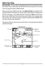
Waypoints are stored positions that allow you to mark areas of interest or
navigation points. Your Fishfinder can store up to 3000 waypoints.
Routes link two or more waypoints together to create a path for navigation, and are
used in trip planning. You can link individual waypoints together by using the GOTO
key. A route represents your intended navigation and shows the shortest path from
each waypoint to the next. As you travel a route, staying on the route line is the
most efficient way to get to your destination, although you should always look out
for obstacles not shown on the chart. Your Fishfinder can store up to 50 routes that
can each contain up to 50 waypoints.
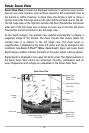
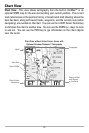
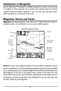
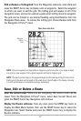
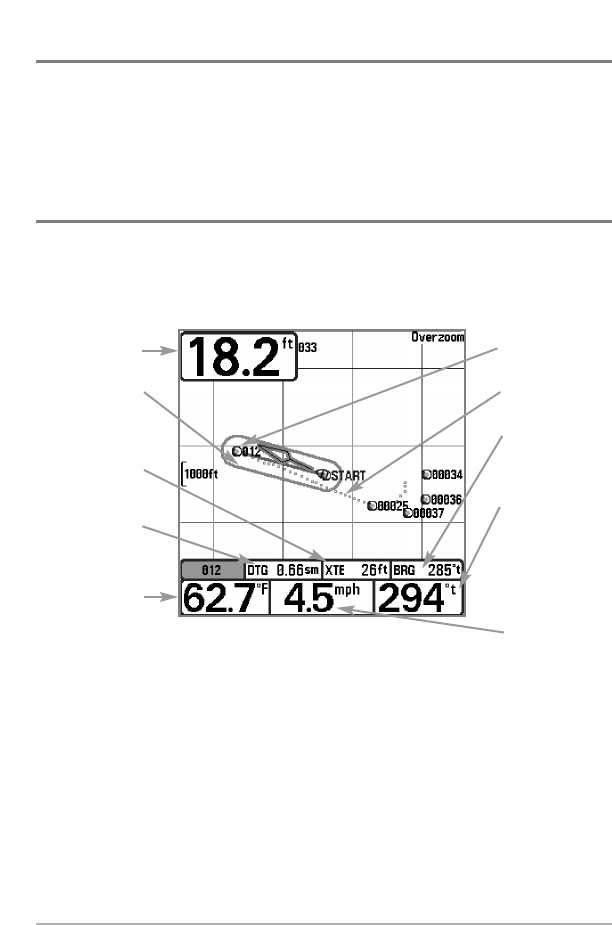
Waypoints, Routes and Tracks
Route
Track
Waypoint
Depth
Water
Surface
Temperature
DTG:
Distance to
Go to
Waypoint
Speed of Boat
XTE: Cross
Track Error.
Distance of
Boat from
Route
Bearing of
Boat with
Respect to
True North
BRG: Bearing
to Waypoint
23