


97
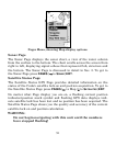
To get to the Full Map press
PAGES|← to MAP|ENT. When the Map
Page is displayed, a screen similar to the following figures appears.
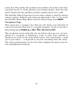
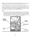
The arrow in the center of the screen is your position. It points in the
direction you are traveling. The flashing line extending from the back of
the arrow is your plot trail. The map zoom range is the distance across
the screen. This number shows in the lower right corner of the screen.
In the first example figure below, the range is 4,000 miles. The Zoom In
and Zoom Out keys zoom the map to enlarge or reduce its coverage area
and the amount of mapping detail shown. There are 40 available map
zoom ranges, from 0.02 miles to 4,000 miles.
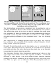
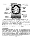
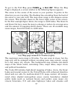
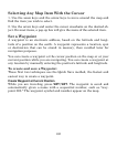
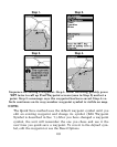
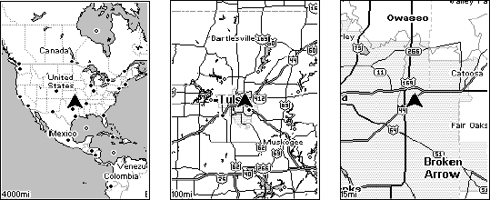
Map Page opening screen (left). Map page zoomed to 100 miles (cen-
ter). Map page zoomed to 15 miles (right).
The maximum zoom range is 20 miles. You can zoom in closer, but the
map only will be enlarged without revealing more map content, except
for a few major city streets. The background map includes low-detail
maps of the whole world, containing cities, major lakes, major rivers
and political boundaries.
The Cuda 250 includes high-detail mapping of lakes, rivers, the Great
Lakes and coastal waters in the United States with enhanced shoreline
detail and nav aids. Its medium-detail U.S. maps contain: all incorpo-
rated cities; shaded metropolitan areas; county boundaries; shaded
public lands (such as national forests and parks); some major city
streets; Interstate, U.S. and state highways; lakes and streams; and