


89
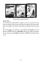
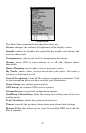
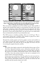
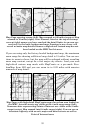
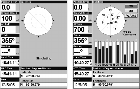
Satellite Status Page. The first figure (left) indicates unit has not locked
on to any satellites and does not have a fix on its position. The second
figure (right) shows satellite lock-on with a 3D position acquired (lati-
tude, longitude and altitude), and WAAS reception.
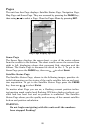
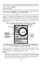
This screen shows a graphical view of the satellites in view. Each satellite is
shown on the circular chart relative to your position. The point in the center
of the chart is directly overhead. The small inner ring represents 45° above
the horizon and the large ring represents the horizon. North is at the top of
the screen. If your unit is facing north, you can use this to see which satel-
lites are obstructed by obstacles in your immediate area.
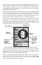
The GPS receiver is tracking satellites that are in bold type. The re-
ceiver hasn't locked onto a satellite if the number is grayed out, there-
fore it isn't being used to solve the position.
Beneath the circular graph are the bar graphs, one for each satellite in
view. Since the unit has twelve channels, it can dedicate one channel
per visible satellite. The taller the bar on the graph, the better the unit
is receiving the signals from the satellite.
NOTE:
One of the data display options for the Satellite Status page is Posi-
tion Error (horizontal position error), which when selected, will ap-
pear in one of the page's digital data boxes. Position Error will show
the expected error from a benchmark location. If the Position Error
is 50 feet, then the position shown by the unit is estimated to be
within 50 feet of the actual location.
It also gives you an indicator of the fix quality the unit currently has.
The smaller the position error number, the more accurate the fix is.
If the position error flashes dashes, the unit has not locked onto the
satellites and the number shown isn't valid.