


3. PLOTTER OPERATION
3-15
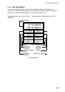
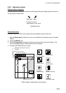
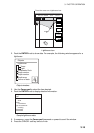
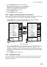
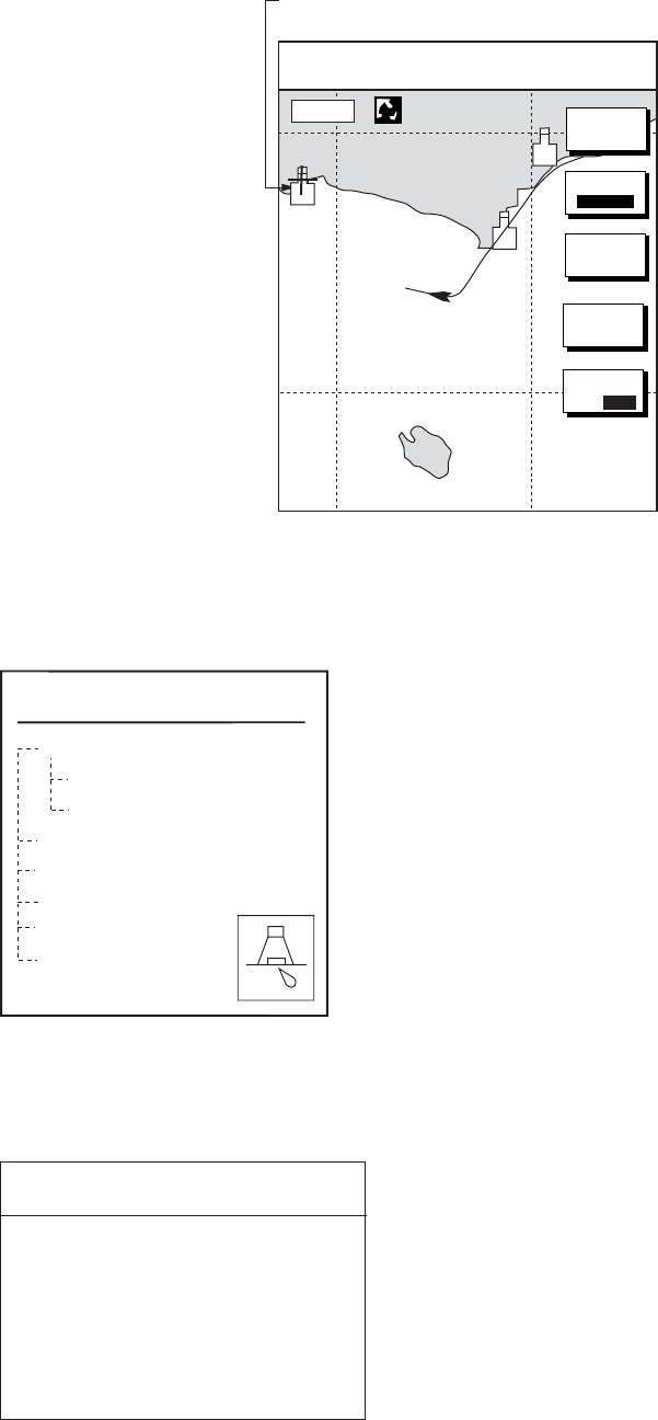
Place the cursor on a lighthouse icon.
34° 22. 3456'N 359.9°
M
TRIP
NU
080° 22. 3456'E
19.9 kt 99.9 nm
GO TO
CURSOR
CENTER
+
MARK
ENTRY
16.0nm
D. BOX
ON /OFF
MODE
NTH UP
Lighthouse icon
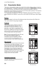
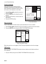
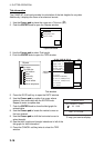
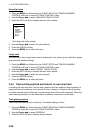
2. Push the ENTER knob to show data. For example, the following window appears for a
lighthouse.
Objects
Lighthouse
Tower
Light
Underwater Rock
Depth contour
Depth contour
Depth area
Source of data
Object windows
3. Use the Cursor pad to select the item desired.
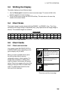
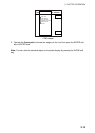
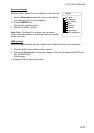
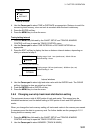
4. Push the ENTER knob to display detailed information.
Color
white
Height
7. 00 Meters
Light characteristic
occulting
XXXXXXXX
XXXXXXXX
Navigation mark, fixed
Light.
Sample lighthouse data
5. If necessary, move the Cursor pad downward or upward to scroll the window.
6. Press the CANCEL soft key twice to finish.