


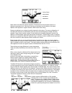
Current information, or the terrain directly beneath your boat, is displayed on the lower right, and
advances to the left as new information is received. The view created is an accurate depiction of
the terrain which you have just covered.
In some situations, the selected point of view may prevent the display of some information due to
the slope of the terrain. An option is available to change the perspective, or viewpoint, which
enables you to see information that would otherwise be masked by the terrain. The Perspective
menu will be discussed in more detail later in this manual under "Control Functions".
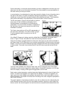
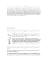
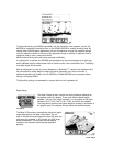
The 2D view shown in Figure B, will be familiar to previous
sonar users. All the information collected by the six
individual beams is compressed into a 2-dimensional
presentation. The most current information is displayed on
the right side of the screen and moves to the left as new
information is received.
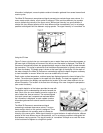
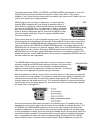
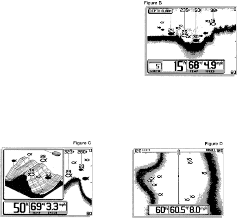
The Combo view combines a 3D and 2D representation of
the same sonar information. This view is shown in Figure
C and is especially useful in learning to use the 3D
presentation.
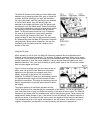
If the Wide 3D Paramount is being used with a Wide Side TM transducer, the default view is
shown in Figure D. Sonar information from both the left and right beams is shown.
Using the view button to toggle between the three main views gives you the maximum benefit of
each type of view: The 3D view gives you an excellent representation of bottom terrain and target
location. The 2D view is best for determining bottom hardness and texture and locating structure
or bottom detail. The combo view combines both 3D and 2D views to provide the best of both
views.
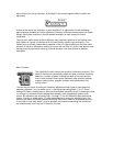
The fourth view available is the "Monster Digits" view, which increases the size of key digital
information so that it can be viewed from a great distance. Normal 2D information is on the right
side of the display. Pressing VIEW again will toggle back to the 3D view.
Depth, water surface temperature, and boat speed are displayed across the lower left part of the
screen. The active menu appears in the upper left of the display. The boat icon appears in the
upper right corner of the display and represents the location of the user's boat relative to the on-
screen information. The location of the boat icon will change if the user changes the perspective.
(see control functions)
The graphic depiction of the bottom provides the user with an effective tool for understanding the
terrain beneath the boat. Each of the six sonar beams transmits a signal at a rate of about four
times a second. the returned signals from each transmit are compared and evaluated before the