


28 |
Chart | Lowrance HDS Gen2 Touch
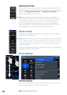
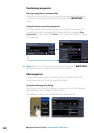
Look ahead
This option centers the chart slightly forward of your vessel so you
can maximize your view ahead.
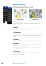
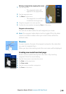
View
The Navionics chart database provides you with detailed coastal
cartography, with 2D and 3D view options.
• 2D presents chart information in a basic mapping mode with
Navionics details
• 3D provides a three dimensional graphical view of land and sea
contours
Synchronize 2D/3D chart
Links the position shown on one chart with the position shown on
the other chart when a 2D and a 3D chart are shown side by side.
You can turn on/off Synchronize 2D/3D from the chart settings
menu when Navionics is the selected chart data.
Community layer
Turns on/off viewing of user generated data downloaded from the
Navionics website.
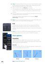
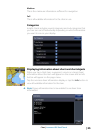
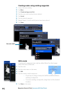
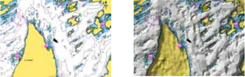
Presentation
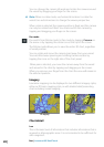
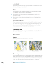
Shading
Shading adds terrain information to the chart.
Traditional 2D chart Chart with shading
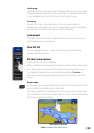
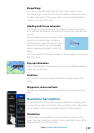
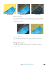
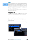
Photo overlay
Photo overlay enables you to view satellite photo images of an area
as an overlay on the chart. The availability of such photos is limited
to certain regions and only available on certain Navionics mapping
cards. You can view photo overlays in either 2D or 3D modes.