


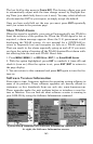

169
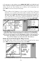
Trail Visible/Invisible and Other Trail Options
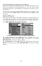
The name, maximum number of points in the trail, activity, and visi-
bility are all changed on the Edit Trail menu screen. The Active setting
determines whether or not LMS-320 is recording new points for a par-
ticular trail.
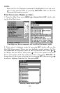
On the Edit Trail menu, press ↓ or ↑ to highlight the section you wish
to change, then press
ENT
. Make your changes, then press
EXIT
to erase
this menu.
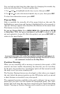
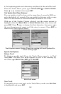
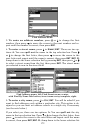
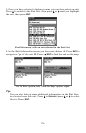
Units of Measure
This menu sets the speed and distance (statute or nautical miles, me-
ters), depth (feet, fathoms, or meters), temperature (degrees Fahrenheit
or Celsius) and heading (true or magnetic) units. To change the units:
Press
MENU
|
MENU
|↓ to
S
YSTEM
S
ETUP
|
ENT
|
ENT
.
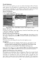
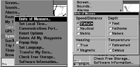
System Setup Menu, left, Units of Measure Menu, right.
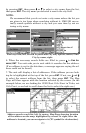
To set Speed/Distance Unit of Measure: Press ↑ or ↓ to change the
Speed/Distance, then press
ENT
. After the option is set, press
EXIT
|
EXIT
|
EXIT
to return to the page display.
To set Heading: Press ↑ or ↓ to change the heading type, then press
ENT
. After the option is set, press
EXIT
|
EXIT
|
EXIT
to return to the page
display.