


Page 28 CP180 / CP180i
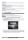
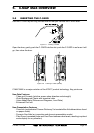
4. A popup window will be shown with Normal, Classic, NOAA, Night and Sunlight. Move
the ShuttlePoint knob to the desired selection and press [ENT] or move the ShuttlePoint
knob to the right.
5. Press [CLR] or move the ShuttlePoint knob to the left to exit the menu and show the
Chart page.
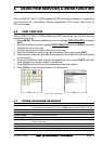
3.5 OTHER SETTINGS IN GENERAL SETUP MENU
You will notice the GENERAL SETUP menu has other selections that allow you to customize:
TIME SETUP Selects a sub-menu to allow the time setup. It is possible to set the GPS Time Offset,
choosing the UTC or Local Time display, and the Time Format, switching 12 or 24 hours
time format.
DATE FORMAT Allows choosing date format MM-DD-YY or DD-MM-YY.
COURSE UP/NORTH UP Selections are:
North Up : The Top of the page is fixed to North
Course Up: The top of the page is orientated to the direction the vessel is heading.
KEYPAD BEEP Allows the beep produced when a key is pressed to be turned on or off.
UNITS OF MEASURE Units of Measure can be selected for Distance, Speed, Depth, Altitude and Temperature.
NAV AIDS PRESENTATION Allows the Nav Aids presentation to be drawn using NOAA symbology when US is
selected or International symbols will be used when International is selected. When
selected these functions affect how the icons for Lights, Signals, Buoys and beacons are
displayed.
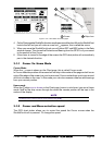
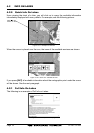
DISPLAY COLOR Changes the background colors of the chart page to enhance the visibility of the screen
depending on the surrounding light conditions. Normal is recommended when the GPS
chart plotter is not exposed to the direct sunlight. When this mode is set the maps are
displayed in order to use colors as similar as possible to ones used in the original paper
charts. Classic uses vivid chart colors presentation. NOAA allows setting NOAA paper
chart colors presentation. Night is recommended when the environment is dark in order
to reduce the glare of the display. The GPS chart plotter displays maps and screen in
darker colors. Sunlight (default) is designed to enhance the visibility of the screen when
the GPS chart plotter is exposed to sunlight. The maps are much brighter than in the other
modes and the depth areas are filled with the white color so different depth areas are not
easily distinguishable.
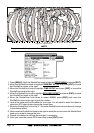
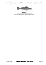
SHIP ICON Allows selection of one of 5 choices of ship icons that represent your vessels position
shown on the chart page.
CURSOR SPEED Selects the preferred speed among Low, Medium and High for the cursor in the Chart page
and within the menu.
MEASURE DISTANCE When this function is turned on allows a distance to be measured between two points
using the ShuttlePoint knob and [ENTER] key
WINDOWS SETUP This menu selection allows the data windows to be customized on the Chart and
Navigation pages.
LANGUAGE Allows changing the language for menus and data screens.
AUTO INFO By default when the cursor is moved over a buoy, Mark or other item a popup window will
show information of the item. This menu item allows the window to be turned on or off.
CURSOR WINDOW By default when the cursor is moved a window is shown with the lat/lon Distance and
bearing from the vessels location to the cursor. This selection allows the window to be
turned off.
CURSOR POSITION The position of the cursor (vessels location) can be customized so it centered in the middle
or centered on the bottom of the chart page. The default is “Center”.
COG TIME LINE Is a line projected from the vessel icon which indicates the distance your vessel will travel
at the current speed. Selections are 2, 10, 30 minutes, 1, 2 hours and infinite.
3.6 INFORMATION PAGE
From Main Menu page it is possible to select an Information page containing Software,