


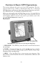
29
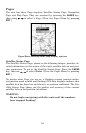
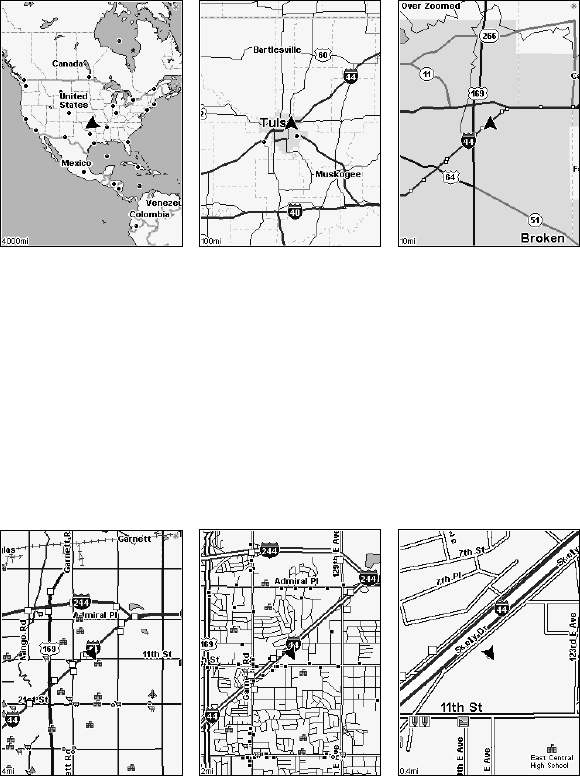
The Zoom In and Zoom Out keys zoom the map to enlarge or reduce its
coverage area and the amount of mapping detail shown. There are 40
available map zoom ranges, from 0.02 miles to 4,000 miles.
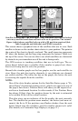
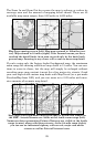
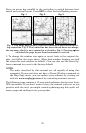
Map Page opening screen (left). Map page zoomed to 100 miles (cen-
ter). Map zoomed to 10 miles (right). Over Zoomed means you have
reached the detail limits in an area covered only by the basic back-
ground map. Zooming in any closer will reveal no more map detail.
If you're using only the factory-loaded background map, the maximum
zoom range for showing additional map detail is 15 miles. You can con-
tinue to zoom in closer, but the map will simply be enlarged without
revealing more map content (except for a few major city streets.) Load
your own high-detail custom map made with MapCreate (or a pre-made
FreedomMap from LEI), and you can zoom in to 0.02 miles with mas-
sive amounts of accurate map detail.
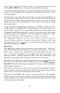
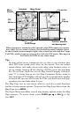
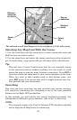
Map Pages with high-detail MapCreate map of urban area loaded on
the MMC. Arterial streets are visible at the 4-mile zoom range (left).
Numerous dots representing Points of Interest are visible at the 2-mile
range (center), along with minor streets. At the 0.4-mile zoom (right),
you can see an interstate highway with an exit, major and minor
streets as well as Point of Interest icons.