


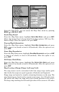
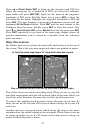
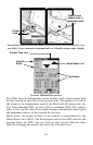
79
Press → to
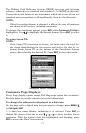
SELECT ORIGIN|ENT to bring up the waypoint and POI list.
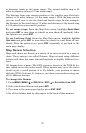
Select the waypoint (or a landmark of POI) you saved the reference
point under and press
ENT|ENT. Spell out the name of the waypoint,
landmark or POI in the Find By Name box or press
ENT to select the
item from the list below. Highlight the waypoint, landmark or POI and
press
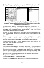
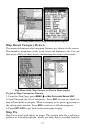
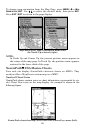
ENT. The unit displays a waypoint information screen with the
command
SET AS ORIGIN selected. Press ENT and the unit returns to the
Configure Map Fix menu. Finally, press
EXIT to close this menu. Now
press ↑ to
COORD SYSTEM|ENT, select MAP FIX from the list and press ENT.
Press
EXIT repeatedly to get back to the main page display where all
position information now is shown as a distance from the reference
point you chose.
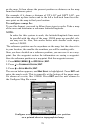
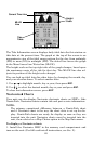
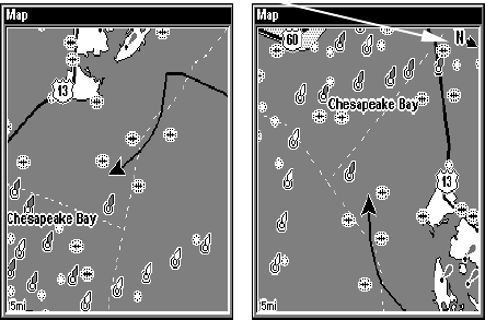
Map Orientation
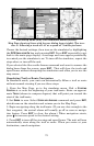
By default, this receiver shows the map with north always at the top of
the screen. This is the way most maps and charts are printed on paper.
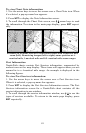
Map orientation shown in north up (left) and track up (right).
This is fine if you are always traveling north. What you see to your left
and right corresponds with the left and ride sides of the map. But if you
travel any other direction, the map does not line up with your view.
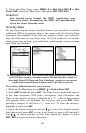
To correct this problem track-up mode rotates the map as you turn. So
what you see on the left side of the screen should always be to your left
and so on.
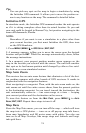
Another option is course-up mode, which keeps the map at the same
orientation as the initial bearing to the waypoint. When either track-up
or course-up modes are on, an "N" shows on the map screen to keep you
aware of which direction is north.
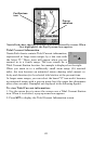
In Track Up mode, map shows "N" show which direction is north.