


74
Tip:
You can pick any spot on the map to begin a simulation by using
the Initialize GPS command. It allows you to move the position ar-
row to any location on the map. The command is detailed below.
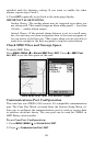
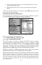
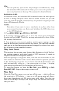
Initialize GPS
In simulator mode, the Initialize GPS command makes the unit operate
as if it is sitting someplace other than its actual location. So you and
your unit could be located in Kansas City, but practice navigating in the
ocean off Islamorada, Florida.
NOTE:
Remember: if you want to run a simulation in a place other than
your current location, you first must Initialize the GPS, then turn
on the GPS Simulator.
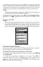
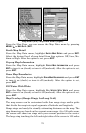
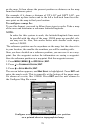
1. Press
MENU|MENU|↓ to GPS SETUP|ENT|ENT.
2. A message appears, telling you to move the cursor near the desired
location and press
ENT. When the message automatically clears, follow
the message instructions.
3. In a moment, your present position marker arrow appears on the
map in the location you selected with the cursor. The unit will consider
that spot as its last known position until changed by either a live satel-
lite lock-on or a new simulator location.
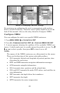
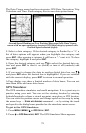
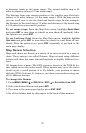
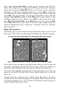
Map Auto Zoom
This receiver has an auto zoom feature that eliminates a lot of the but-
ton pushing common with other brands of GPS receivers. It works in
conjunction with the navigation features.
Start navigating to a waypoint. Then, with the auto zoom mode on, the
unit zooms out until the entire course shows, from the present position
to the destination waypoint. As you travel toward the destination, the
unit automatically zooms in — one zoom range at a time — keeping
your current position and the destination on the screen.
To turn this feature on from the
MAP PAGE, press MENU|↓ to AUTO
ZOOM|ENT|EXIT. Repeat these steps to turn it off.
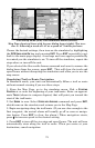
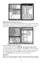
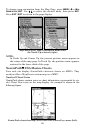
Map Data
From the Map Data menu, you can turn off the map — which will turn
the map into a GPS plotter — turn on or off pop-up map info boxes,
draw map boundaries and fill water areas with white. You also can
turn on or off Map Overlays, like range rings and latitude and longi-
tude grid lines.