


15
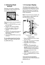
1.16 Setting Up Nav Data
Displays
The user may arrange the nav data
displays as desired.
1. Use the [MODE] key to show the
NAV DATA-1 or 2 display, whichever
you want to set up.
2. Press the [MENU/ESC] key to close
the mode selection window.
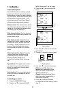
3. Press the cursor pad to display the
NAV DATA SETUP window.
NAV DATA SETUP
/ : Window Selection
/ : Data Selection
[MENU]: Exit
NAV DATA SETUP window
4. Use ▲ or ▼ to choose a data
display window desired. A
dashed-line rectangle circumscribes
your selection.
5. Use ◄ or ► to choose item to
display. See the below for a
description of the displays.
(9)
(1)
(2)
(3)
(4)
(5)
(6)
(7)
(8)
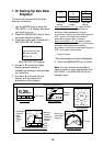
Two-data
display
Three-data
display
Four-data
display
Items displayable in (1) - (3): depth, position,
course, range and bearing, trip distance,
odometer, water temperature, heading,
air pressure, time-to-go to destination waypoint,
XTE*, speed*, wind speed and direction*,
destination waypoint data*, compass*
Items displayable in (4) - (9): depth, position,
speed, course, range and bearing, trip distance,
odometer, water temperature, heading,
air pressure, time-to-go to destination waypoint,
XTE*, wind speed, wind direction
* = Graphic display
Nav data window and item displayable
6. Press the [MENU/ESC] key to finish.
Note: You can choose the number of
items to show in a nav data display with
NAV DATA-1 and NAV DATA-2 on the
System menu.
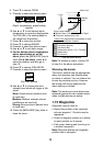
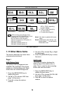
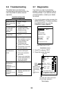
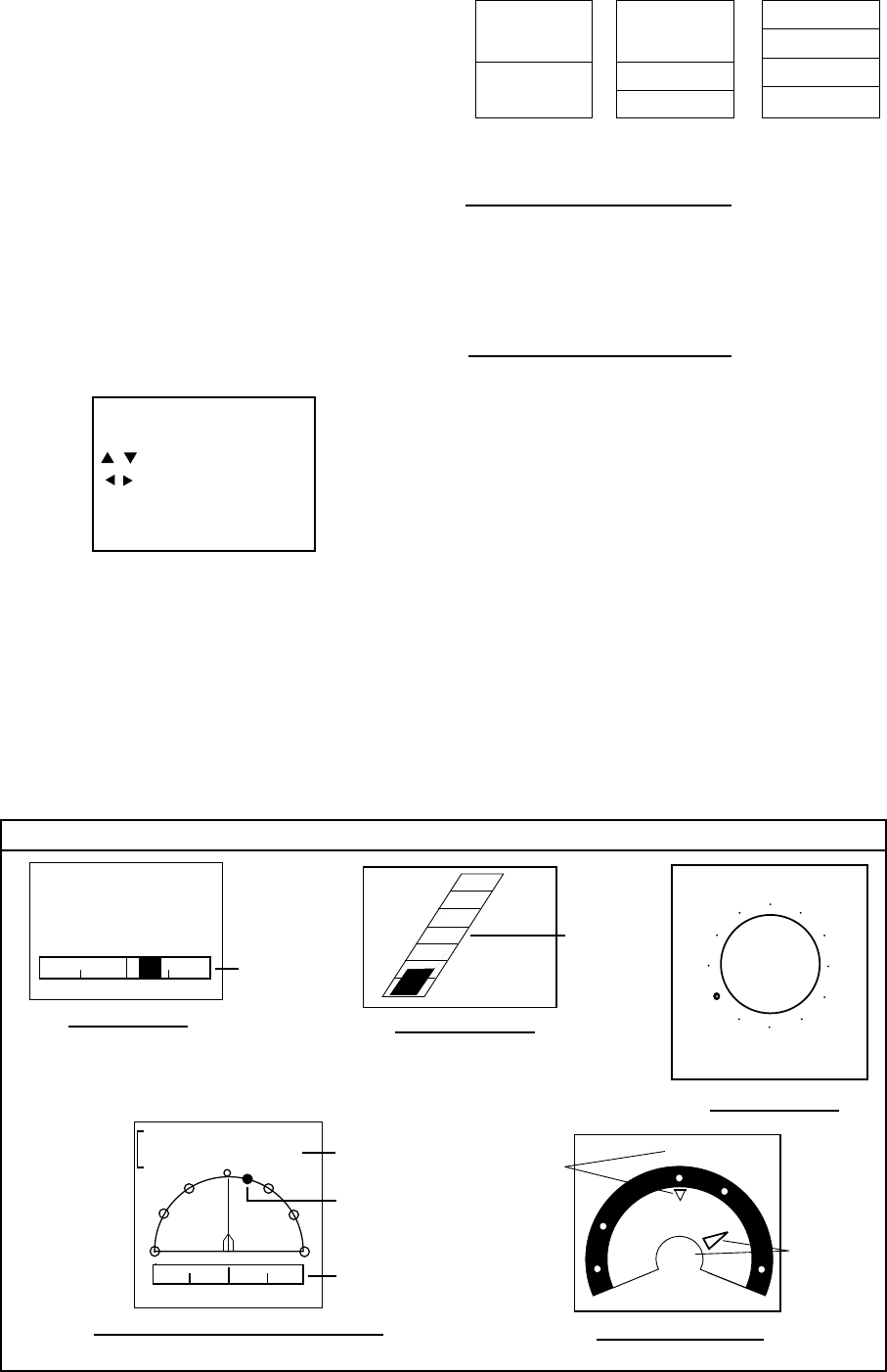
GRAPHIC DISPLAYS
1 0.5 0 0.5 1
Wpt 03
Rng 0.19nm Brg 321°
XTE 0.00nm Cse 333°
DESTINATION WAYPOINT GRAPHIC
XTE
scale
Bearing,
Course
Destination
waypoint
direction
Destination
waypoint
data:
Name,
Range,
XTE
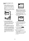
Wind APP*
WIND GRAPHIC
60
120
90
0
30
150
180
120
150
90
60
30
120°
Speed
10.3
m/s
COMPASS GRAPHIC
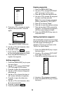
SPEED GRAPHIC
17.2
Speed
20
50
40
60
30
10
0
1 0.5 0 0.5 1
0.25
nm
XTE
XTE GRAPHIC
kt
Bearing to
destination
waypoint
Course
Brg
30°
Cse
90°
N
E
XTE scale
Speed-
ometer
Nav data display-1