


24
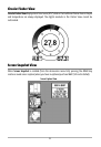
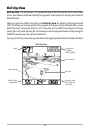
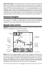
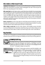
Nearest Current Station: Current information for the nearest current station to your present
position will be displayed. This includes the position of the station and the current changes for
today. Two graphs are also presented that show the time, direction and flow speed of the current
changes for the 24 hour time period of today’s date. You can change the date to look at current
information before or after the date displayed by pressing the LEFT or RIGHT cursor key
respectively. Press the EXIT key to remove the information box and the cursor bull’s eye will be
centered over the current station position. The cursor information boxes at the bottom of the
display will indicate the distance and bearing to the current station from your present position.
Introduction to Navigation
Use the 700 Series™ Fishing System to establish waypoints at areas of interest and to navigate to
those waypoints via a savable route (representing the shortest intended distance between
waypoints). You can also view and save tracks, which represent the actual path of the boat.
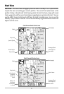
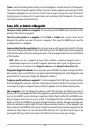
Waypoints, Routes and Tracks
Waypoints are stored positions that allow you to mark areas of interest or navigation points. Your
700 Series™ Fishing System can store up to 750 waypoints.
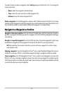
Routes link two or more waypoints together to create a path for navigation, and are used in trip
planning. You can link individual waypoints together by using the GOTO key. A route represents
your intended navigation and shows the shortest path from each waypoint to the next. As you
travel a route, staying on the route line is the most efficient way to get to your destination,
although you should always look out for obstacles not shown on the chart. Your 700 Series™
Fishing System can store up to 50 routes that can each contain up to 50 waypoints.
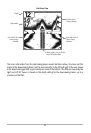
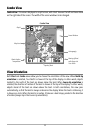
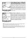
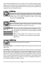
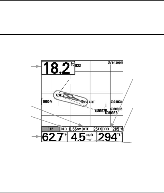
Waypoints, Routes and Tracks
Route
Track
Waypoint
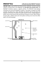
Depth
Water Surface
Temperature
DTG: Distance
to Go to
Waypoint
Speed of Boat
XTE: Cross
Track Error.
Distance of
Boat from
Route
Bearing of
Boat with
Respect to
True North
BRG: Bearing
to Waypoint