27
Waypoints, Routes, and Tracks
Waypoints are stored positions that allow you to mark areas of interest or
navigation points. Your Fishfinder can store up to 3000 waypoints.
NOTE: When two or more waypoints overlap, or are displayed close together on a
chart view, the screen will automatically declutter—waypoint names will shorten
and the waypoint icons will change into small blue icons.
To view a Decluttered Waypoint at full size, use the 4-WAY Cursor Control key to
move the cursor onto a decluttered waypoint icon. When the cursor snaps onto the
icon, the full-size waypoint name and icon will be displayed. You can also press the
ZOOM+ key until you can see the individual waypoints on the screen.
Waypoints, Routes, and Tracks
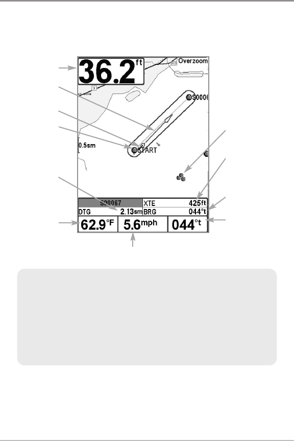
Decluttered
Waypoints
XTE: Cross Track
Error. Distance
of Boat from
Route
BRG: Bearing to
Waypoint
Bearing of Boat
with Respect to
True North
Depth
Route
Track
Waypoint
DTG:
Distance to
Go to
Waypoint
Water
Surface
Temperature
Speed of Boat
Introduction to Navigation


