


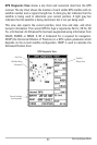
51
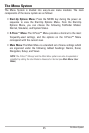
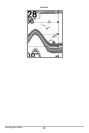
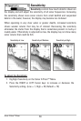
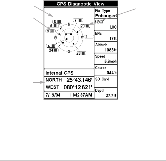
GPS Diagnostic View shows a sky chart and numerical data from the GPS
receiver. The sky chart shows the location of each visible GPS satellite with its
satellite number and a signal strength bar. A dark gray bar indicates that the
satellite is being used to determine your current position. A light gray bar
indicates that the satellite is being monitored, but is not yet being used.
This view also reports the current position, local time and date, and other
numeric information. The current GPS Fix Type is reported as No Fix, 2D Fix, 3D
Fix, or Enhanced. An Enhanced fix has been augmented using information from
WAAS, EGNOS, or MSAS. A 3D or Enhanced Fix is required for navigation.
HDOP (the Horizontal Dilution of Precision) is a GPS system parameter which
depends on the current satellite configuration. HDOP is used to calculate the
Estimated Position Error.
GPS Diagnostic View
Satellite
Being Used
Current Latitude
and Longitude
Sky Chart
Satellite Being
Monitored
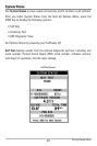
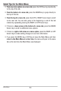
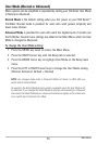
Start-Up Options Menu