


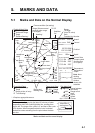

5. MARKS AND DATA
5-3
Description of marks and data on the normal display (con't from previous page)
N
S
WE
1
3
2
° . N
° . E
500
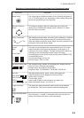
Mark/Data Description
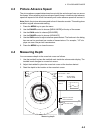
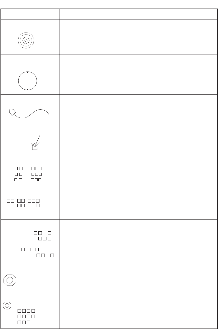
Range Rings
The range rings are dashed concentric circles inscribed at intervals of
1/4 or 1/2 of the range in use, depending on menu setting. Range ring
data is also provided every two range rings.
Electronic Bearing
Scale*
The electronic bearing scale is the outermost ring on the sonar
display and is available with heading sensor connection. It rotates
with own ship's movement.
Ship's Track Mark*
With heading and speed data, own ship's track is plotted by a solid line.
The track length can be selected among five or ten times the range.
When the length exceeds the chosen length, the track is erased so that
its length is equal to the chosen length.
Current
Mark*
Current Data*
This mark can be displayed with current indicator input. The current
marks show tidal current speed and direction in three layers (1-3),
selected on the current indicator. The tidal current speed is shown by
the length of the line extending from the center of the mark.
Current direction can be shown as [to] or [from] with [CURRENT DIR]
on the [MARKS] menu.
Current speed range: 0.0 to 9.9 kt
Direction range: ±180° or 0-359°
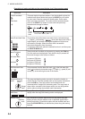
Own Ship Position Data*
With navigation input, position can be displayed in latitude and long-
itude (or Loran C TDs) in the text window.
Latitude range: 90°00.000S to 90°00.000N
Longitude range: 179°59.999S to 179°59.999E, 180°00.000
With appropriate sensors, speed, course, water depth and
water temperature can be displayed in the text window.
Speed range: 0.0-40 kts
Course range: 0-359°
Depth range: 0-9999 m (same range for any depth unit)
Water temperature range: -10.0 to 40.0 °C
Nav Data*
SHIP SPEED: . kt
SHIP COURSE:
°
C1: . kt
°
C2: . kt
°
C3: . kt
°
DEPTH: m
WATER TEMP: .
°
Target Lock Mark*
Target Lock Mark Data*
→
↓
B °
The target lock mark automatically tracks the fish school selected
by the operator. This function requires speed and heading data.
The slant range (→), depth (↓) and bearing (B) of the fish echo are
shown at the bottom left corner on the sonar display.