


7. Vector Charts
7-56
7.9.4 Display base
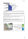
A subset of chart features is called the Display Base. As required by IMO, these features cannot be made invisible.
The Display Base consist of the following chart features:
• Coastline (high water)
• Own ship's safety contour, which is chosen by the user
• Indication of isolated underwater dangers of depths less than the safety contour that lie within the safe waters
defined by the safety contour
• Indication of isolated dangers that lie within the safe water defined by the safety contour such as bridges,
overhead wires, etc., and including buoys and beacons whether or not these are being used as aids to navigation.
• Traffic routine systems
• Scale, range, orientation and display mode
• Units of depth and height
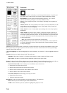
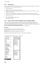
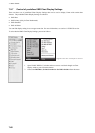
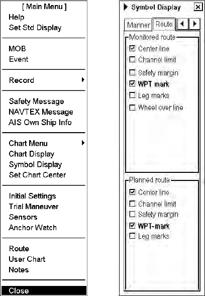
7.9.5 How to control visible navigation features (Symbol display)
Visibility control of the navigation features is divided into five pages in the Symbol Display dialog box. The
"Route" page controls planned and monitored route. The "Tracking" page controls past tracks and some other
features. The "Mariner" page controls Notes and user charts. The "Targets" page controls TT and AIS targets. The
"General" page controls own ship and target related things.
The user can define settings for chart details that are displayed over the chart area.
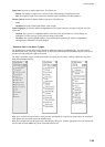
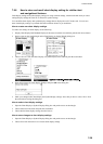
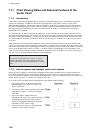
Route page
This page contains selection of route related navigation features
Monitored route: Choose which part of monitored route to display.
Planned route: Choose which part of planned route to display.
Note: WPT mark on both monitor and planned routes is set permanently to Std position.
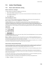
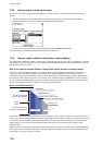
Open Main menu and select Symbol Display from the menu.