


11-1
11. How to Monitor Routes
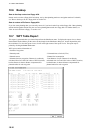
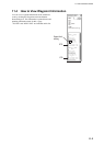
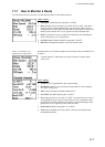
Route monitor is a means for permanent monitoring of the ship’s behavior relative to the monitored route. The
information area displays the data on the ship’s position relative to the monitored route. The monitored route
consists of the following information, displayed in the electronic chart area:
• The route is displayed with red dots.
• The limits of channels of each leg are displayed with solid red lines. These limits are used to detect chart alerts
when you are monitoring the route. For further details, see section 9.1 Chart Alerts.
• Each leg has information about planned speed, shown inside a rectangle.
• Each leg has information about planned course to steer.
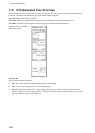
Note: In order to display charts with correctly updated situation, always use current date as Approve Until and
Display Until during your voyage. If your voyage lasts more than one week, set current date at least once per week
during your voyage. For more information, see section 7.11 Chart Viewing Dates and Seasonal Features of the
Vector Chart.
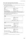
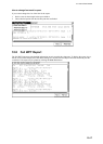
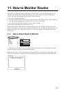
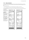
11.1 How to Select Route to Monitor
Select Route
Monitor
Plan
X
Route: not selected
To choose the route to monitor, put the cursor on Route in the sidebar, put the cursor in the Monitor combo box,
spin the scrollwheel to choose route then push the scrollwheel.
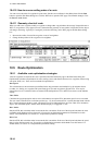
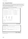
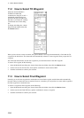
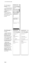
Note: When you choose a route for monitoring, the message shown below may appear when the geometry of the
route makes it impossible to sail the ship. Choose the Plan Route dialog box and make necessary modifications.